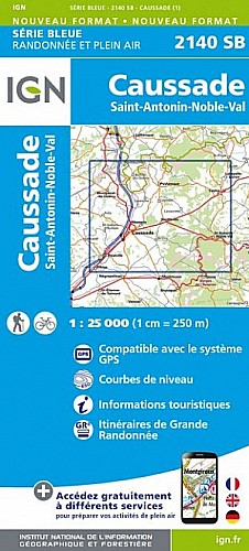
Départ : parking du Cirque de Bône au dessus de St Antonin Noble Val. Très belle boucle qui surplombe l'Aveyron, la traverse, va jeter un coup d'oeil au village de Brousse, flâne sur les bords de l'Aveyron avant de remonter au point de départ.
95% chemins, souvent spectaculaires et 95% ombre.
 Actions
19 km

+640 m/-641 m

06:00

Cliquez pour activer


Cliquez et déplacez la souris sur le profil pour analyser un tronçon (2 doigts sur mobile)
Commentaires
Pas encore de commentaire, connectez-vous pour en ajouter un.
Connectez-vous pour ajouter un commentaire
Longueur et nombre de points

19.24 km

1744 pts
Denivelé et altitude
Calculés avec un seuil de 10 mètres et un lissage sur 5 points

639 m

642 m

339 m

84 m

215 m
Date et durée

29 août 2015
08:48

29 août 2015
16:08

07:19:39

05:59:00

01:20:39
Vitesses et denivelés horaires

3.2 km/h
Détail »

4.9 km/h
au km 13.1

258 m/h
2h11m20s

-299 m/h
1h49m29s
| km | Temps | Vitesse | Pause |
|---|
| 1 | 17'50" | 3.4 km/h | 04'47" |
| 2 | 23'24" | 2.6 km/h | 03'23" |
| 3 | 15'37" | 3.8 km/h | |
| 4 | 14'21" | 4.2 km/h | 04'03" |
| 5 | 16'11" | 3.7 km/h | |
| 6 | 19'26" | 3.1 km/h | 01'56" |
| 7 | 26'14" | 2.3 km/h | |
| 8 | 19'59" | 3 km/h | 04'17" |
| 9 | 19'22" | 3.1 km/h | 33'29" |
| 10 | 17'32" | 3.4 km/h | |
| 11 | 14'24" | 4.2 km/h | |
| 12 | 24'57" | 2.4 km/h | 02'58" |
| 13 | 16'27" | 3.6 km/h | 03'21" |
| 14 | 14'38" | 4.1 km/h | |
| 15 | 16'14" | 3.7 km/h | |
| 16 | 19'29" | 3.1 km/h | 17'39" |
| 17 | 15'48" | 3.8 km/h | 02'34" |
| 18 | 16'57" | 3.5 km/h | |
| 19 | 24'47" | 2.4 km/h | 02'12" |
Dépense calorique (estimation)

691 Cal
115 Cal/h
Plus

Affichée 2224 fois et téléchargée 79 fois depuis le 31.08.15 15:10
Carte + Profil [Afficher un aperçu]
<iframe src="https://www.visugpx.com/zxw8ZlK8hR?iframe" allowfullscreen style="border: 0;width: 100%; height: 540px;" scrolling="no"></iframe>
Carte uniquement [Afficher un aperçu]
<iframe src="https://www.visugpx.com/zxw8ZlK8hR?iframe&maponly" allowfullscreen style="border: 0;width: 100%; height: 540px;" scrolling="no"></iframe>

Nous avons pris en compte votre choix.
Vous souhaitez maîtriser les informations qui peuvent être recueillies lors de votre navigation et avez refusé les cookies de personnalisation des annonces, c'est légitime.
Parce que le service fourni par VisuGPX a un coût, accepteriez-vous quand même que nous utilisions des cookies pour vous présenter des annonces non personnalisées ? Ces cookies ne sont pas des cookies de tracking mais de simples des cookies techniques de diffusion qui garantissent le respect votre vie privée.


 Actions
  19 km
19 km +640 m/-641 m
 06:00
06:00

 Cliquez et déplacez la souris sur le profil pour analyser un tronçon (2 doigts sur mobile)
 73
73 138
138 70 [Légende]
 Pour soutenir VisuGPX, faites le bon choix