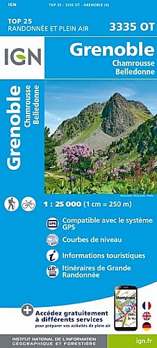
Surtout ne pas oublier les couteaux, ils seront très utiles. Pour la descente, je vous déconseille d'emprunter le "Couloir de Casserousse" qui est aussi fermé. La première portion de ce couloir est verglacée. Il est préférable d'emprunter la Croix de Chamrousse, puis une piste non fermée vers le parking. C'était une superbe balade.
 Actions
12 km

+1304 m/-1284 m

04:00

Cliquez pour activer


Cliquez et déplacez la souris sur le profil pour analyser un tronçon (2 doigts sur mobile)
Segments 
Récupération des segments

Commentaires
Pas encore de commentaire, connectez-vous pour en ajouter un.
Connectez-vous pour ajouter un commentaire
Longueur et nombre de points

12.2 km

1353 pts
Denivelé et altitude
Calculés avec un seuil de 10 mètres et un lissage sur 5 points

1303 m

1285 m

2505 m

1457 m

2029 m
Date et durée

06 février 2020
08:13

06 février 2020
14:16

06:03:12

04:01:35

02:01:37
Vitesses et denivelés horaires

3 km/h
Détail »

57.1 km/h
au km 10.6

409 m/h
3h03m50s

-1362 m/h
0h53m53s
| km | Temps | Vitesse | Pause |
|---|
| 1 | 27'12" | 2.2 km/h | 01'43" |
| 2 | 25'05" | 2.4 km/h | 01'19" |
| 3 | 26'19" | 2.3 km/h | 07'32" |
| 4 | 24'30" | 2.4 km/h | 11'24" |
| 5 | 30'49" | 1.9 km/h | 21'53" |
| 6 | 34'43" | 1.7 km/h | 41'00" |
| 7 | 10'03" | 6 km/h | 02'01" |
| 8 | 24'17" | 2.5 km/h | 06'56" |
| 9 | 19'36" | 3.1 km/h | 27'49" |
| 10 | 08'28" | 7.1 km/h | |
| 11 | 05'13" | 11.5 km/h | |
| 12 | 01'58" | 30.5 km/h | |
Dépense calorique (estimation)

877 Cal
218 Cal/h
Plus

Affichée 312 fois et téléchargée 11 fois depuis le 07.04.20 15:25
Carte + Profil [Afficher un aperçu]
<iframe src="https://www.visugpx.com/qesTjfCCrJ?iframe" allowfullscreen style="border: 0;width: 100%; height: 540px;" scrolling="no"></iframe>
Carte uniquement [Afficher un aperçu]
<iframe src="https://www.visugpx.com/qesTjfCCrJ?iframe&maponly" allowfullscreen style="border: 0;width: 100%; height: 540px;" scrolling="no"></iframe>

Nous avons pris en compte votre choix.
Vous souhaitez maîtriser les informations qui peuvent être recueillies lors de votre navigation et avez refusé les cookies de personnalisation des annonces, c'est légitime.
Parce que le service fourni par VisuGPX a un coût, accepteriez-vous quand même que nous utilisions des cookies pour vous présenter des annonces non personnalisées ? Ces cookies ne sont pas des cookies de tracking mais de simples des cookies techniques de diffusion qui garantissent le respect votre vie privée.


 Actions
  12 km
12 km +1304 m/-1284 m
 04:00
04:00

 Cliquez et déplacez la souris sur le profil pour analyser un tronçon (2 doigts sur mobile)


 150
150 377
377 159 [Légende]
 Pour soutenir VisuGPX, faites le bon choix