Créer une traceVisualiser une traceBibliothèqueCartesCommunauté ForumsToposLes plus belles randosSegmentsOutdoor StoriesOffre PremiumConnexion
VisuGPX
Sélectionner un fichier
.gpx .fit .tcx
Options
Le seuil et le lissage permettent d'optimiser le calcul du denivelé
Inscription
Entrez votre email et récupérez votre mot de passe dans votre boite
Ou
Connexion
Entrez l'email et le mot de passe que vous avez reçu lors de votre inscription
julien.chopard
Contact julien.chopard

 
Traces
 
Activité
 

Traces

Dossier (n°0)

Trier
Afficher la carto dossier et sous-dossiers | ce dossier uniquement ⚠️ Selon le nombre de traces l'affichage peut-être long
Pas de tags. Définissez des #tags dans la description de vos traces pour les retrouver plus rapidement
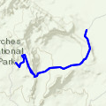
  • Tower Arch Trail 01.08.2023 20:03 · Randonnée Pédestre · 5 km · 113 vus · 6 téléchargements ·
    For those frustrated with the crowds present on the popular hikes in Arches National Park, there is a remedy. Take a well-maintained dirt road for 8 miles through Salt Valley to the Klondike Bluffs parking lot, where there won't be any tour buses, and prepare for a wonderful hike to one of the most impressive arches in the park. Description Although the Tower Arch Trail can be started from either

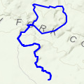
  • Peek-A-Boo & Spooky Slot Canyons 07.10.2023 17:51 · Randonnée Pédestre · 7 km · 353 vus · 6 téléchargements ·
    Southern Utah is amassed with unique slot canyon adventures, but its difficult to find ones with narrower passages than the Peek-a-boo and Spooky side canyons of the Dry Fork Coyote Gulch. They are in fact so tight that hike may not be comfortable for claustrophobic or heavyset people. Both canyons get very narrow but Spooky, in particular, might make you suck it in a lot! Need to Know Directions:

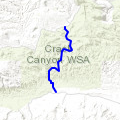
  • Little Wild Horse Canyon Trail 28.02.2022 17:08 · Randonnée Pédestre · 6 km · 53 vus · 5 téléchargements ·
    While you'll experience breathtaking beauty in the canyon, this trail makes even seasoned hikers earn their scenic views! Little Wild Horse Canyon is fairly narrow, and you'll want to be aware that there are some tight squeezes and drop-offs along the way. The trail narrows pretty quickly, though the first 1.5 miles from the trailhead are mostly open. From the trailhead, and the junction with th

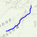
  • Zebra Slot Canyon 23.05.2023 22:38 · Randonnée Pédestre · 8 km · 38 vus · 5 téléchargements ·
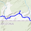
    Zebra Canyon is a photographer's dream. Shape shifting walls undulate in synchronous waves, striated with streaks of pink and magenta. The light plays as if in a prism of colorful stone, reflective water, and a sliver of sky. The length of the canyon itself is short, but you could linger for a long time trying to get just the perfect picture of the scene. The hike to get here requires some effort,

  • Buckskin Gulch 17.05.2023 18:57 · Randonnée Pédestre · 24 km · D+260 m · 109 vus · 25 téléchargements ·
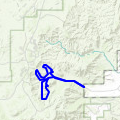
    Buckskin Gulch (with Wire Pass shortcut and Middle route shortcut options) https://www.visitutah.com/things-to-do/slot-canyons/buckskin-gulch https://www.visitutah.com/places-to-go/parks-outdoors/grand-staircase-escalante/hiking/middle-route-buckskin-gulch https://www.summitpost.org/the-drop-into-buckskin/846409/c-846511

  • Bryce Canyon Loop from Tropic trailhead 07.05.2023 18:18 · Trail · 14 km · D+600 m · 54 vus · 12 téléchargements ·
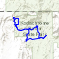
    Big loop into Bryce Canyon starting from Tropic trailhead and following Peekaboo - Navajo - Queen's Garden trail paths

  • Panorama Trail - Cool Cave Loop 08.03.2022 21:04 · Trail · 9 km · 135 vus · 13 téléchargements ·
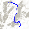
    The trail starts on the western side of the road and heads towards the rock formations straight ahead. When you reach the first junction, stay on the right and follow the signs. You'll pass the Ballerina Spire and the Hat Shop, two interesting geological features. After passing the Secret Passage spur on the right, the trail makes a sharp left turn and heads south and take right at the junction to

  • Kanab - Mansard Trail 09.07.2025 12:03 · Trail · 3 km · D+260 m · 94 vus · 21 téléchargements ·
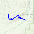
    Le sentier Mansard est un sentier de randonnée d'environ 8 kilomètres aller-retour situé près de Kanab, dans l'Utah. Il est considéré comme un sentier modérément difficile, avec un dénivelé d'environ 300 mètres. Le sentier offre de belles vues sur Kanab et les plateaux du nord de l'Arizona, ainsi que des pétroglyphes uniques. Informations clés: Localisation: Le sentier se t

  • Great Sand Dunes - Star Dune Out-and-Back 15.01.2022 22:21 · Randonnée Pédestre · 14 km · D+360 m · 52 vus · 5 téléchargements ·
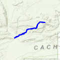
    Overview A route that will take you from the main parking lot to High Dune and Star Dune. Need to Know Bring lots of water, sunscreen, and potentially an umbrella. Description Start in the parking lot. Once you cross the creek, you'll need to look for the tallest dune you can see. It should be right in front of you. Work your way up to the top of High Dune. It is best to zig zag, or switchback so

  • Delicate Arch Trail 04.08.2023 00:41 · Randonnée Pédestre · 5 km · 202 vus · 9 téléchargements ·
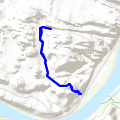
    Overview Delicate Arch is a magnificent, free-standing arch recognized the world over. This trail to its base is fun-filled and unique- visiting petroglyphs and a smaller arch, climbing slickrock hillsides and traversing an exciting, exposed ledge. Need to Know Just before you get to Delicate Arch, the trail goes along a rock ledge for about 200 yards. This part is not scary for those without an e

  • Longbow Arch Trail (Longview Arch) 24.01.2023 19:00 · Randonnée Pédestre · 3 km · 43 vus · 5 téléchargements ·
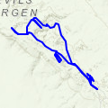
    Overview Longbow Arch is a short out-and-back hike to a beautiful arch formation tucked away in the rolling slickrock above Potash Road outside of Moab, Utah. The trailhead shares a moderately sized parking area with the Poison Spider Trail, a well popular jeep trail. Description The trailhead begins at the northeast end of the parking area, initially paralleling Potash Road while meandering up a

  • Devils Garden Full Lollipop 06.08.2023 18:18 · Randonnée Pédestre · 12 km · D+240 m · 43 vus · 9 téléchargements ·
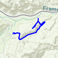
    Overview This second most popular trail in Arches has a well deserved reputation for amazing scenery in a wonderfully remote setting. This is your chance to visit 8 named arches and with keen eyes you'll spot many more. Need to Know Take at least 1 quart (1 liter) of water per person, wear a hat, use sunscreen, take breaks, be self-sufficient. Visit early or late in the day if you want to avoid th

  • Cohab Canyon and Fruita Overlooks 21.06.2023 00:54 · Randonnée Pédestre · 5 km · D+230 m · 40 vus · 6 téléchargements ·
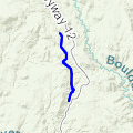
    Overview Staying in Fruita Campground in Capitol Reef National Park has many rewards, but one is the close proximity of several trailheads leading out of the oasis and into the surrounding canyons. One of the best is the Cohab Canyon Trail, which starts right across the road from the campground entrance. This rewarding hike is challenging at first, but it has tremendous views and scenery as a rewa

  • Lower Calf Creek Falls 23.05.2023 22:33 · Randonnée Pédestre · 9 km · 52 vus · 7 téléchargements ·
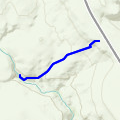
    Overview Lower Calf Creek Falls is one of the geological gems nestled in the Grand Staircase-Escalante National Monument, a region rich with natural wonders. The hike to the waterfalls is relatively short with minimal elevation gain, but nearly the entirety is through sand, which can make for slow going. The terminus of the hike is a majestic 130-foot tall waterfall cascading into a pool practical

  • Upper Calf Creek Falls 24.05.2023 19:33 · Randonnée Pédestre · 3 km · 54 vus · 6 téléchargements ·
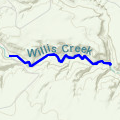
    Overview The lesser-traveled alternative to Lower Calf Creek Falls, this is an open desert hike on trail and slickrock to a hidden waterfall and refreshing swimming hole. Description From the trailhead, descend steeply over slickrock, passing rounded basalt boulders that erupted from the Boulder Mountain volcanic area around 20 million years ago. They were transported to Calf Creek by huge debris

  • Willis Creek Slot Canyon 24.05.2023 17:32 · Randonnée Pédestre · 4 km · 37 vus · 8 téléchargements ·
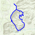
    Family Friendly A scenic route including a small waterfall. You'll be hiking along the creek bottom with plenty of chances to get the feet wet if you want. Flash flood danger: Do not enter this canyon if there is possibility of rain nearby. Overview Willis Creek is a great family outing located near Bryce Canyon National Park. No real difficulties are encountered, the outing is as long or short as

  • Bryce Canyon - Queens Garden Navajo Loop Trail 18.07.2023 19:24 · Trail · 5 km · 130 vus · 18 téléchargements ·
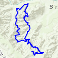
    Ideally, get an early start, arriving in the park no later than 8 am. Park in the Sunset Point Parking lot and hike the Queen’s Garden and Navajo Trail Loop. This hike takes 2 to 3 hours, which gives you some time to visit a few overlooks.

  • Bryce Canyon - Peek-A-Boo Loop 07.05.2023 17:18 · Trail · 8 km · D+410 m · 62 vus · 9 téléchargements ·
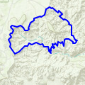
    This is a longer, more strenuous trail than the Queen’s Garden Navajo Loop, but your reward is some of the best views of hoodoos in the park.

  • Bryce Canyon - Fairyland Loop 18.07.2023 18:49 · Trail · 12 km · D+420 m · 75 vus · 11 téléchargements ·
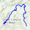
    Tucked away from the park’s busier viewpoints, the Fairyland Loop offers jaw-dropping vistas, towering hoodoos, and a sense of solitude that’s hard to find on more popular routes. It’s a tough hike, but the reward is a scenic walk through one of the most beautiful landscapes in the American Southwest. The Fairyland Loop is often overlooked by many visitors to Bryce Canyon, and we are no dif

  • Grand Canyon National Park : South Kaibab & Bright Angel Trails 22.09.2024 15:37 · Trail · 35 km · D+2450 m · 151 vus · 11 téléchargements ·
    The South Kaibab and Bright Angel Trails are two of the Grand Canyon’s classic hiking trails. You can combine these two trails together to create one massive day hike or a two-day backpacking trip. With its long distance and nearly a mile of elevation gain, this is a beast of a hike. However, there is something very special about starting on the rim, hiking down to the Colorado River, and then w

Stats globales

  • Nombre de traces : 20
  • Distance cumulée : 193 km (Moyenne : 10 km)
  • Dénivelé cumulé : 6570 m (Moyenne : 330 m)
  • Nb vu : 1890 (Moyenne : 95)
  • Nb téléchargements : 197 (Moyenne : 10)
Pour soutenir VisuGPX, faites le bon choix
En cliquant sur "accepter" vous autorisez l'utilisation de cookies à usage technique nécessaires au bon fonctionnement du site, ainsi que l'utilisation d'autres cookies (éventuellement tiers) à des fins statistiques ou de personnalisation des annonces pour vous proposer des services et des offres adaptées à vos centres d'interêt.

Vous pouvez à tout moment modifier ce choix ou obtenir des informations sur ces cookies sur la page des conditions générales d'utilisation du service :
REFUSER
ACCEPTER