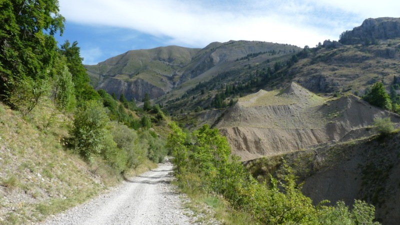
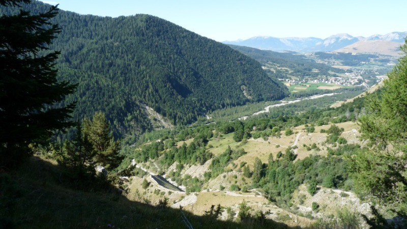
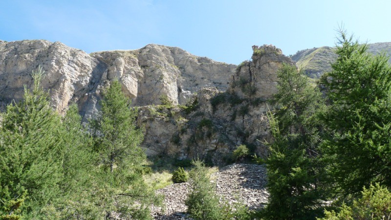
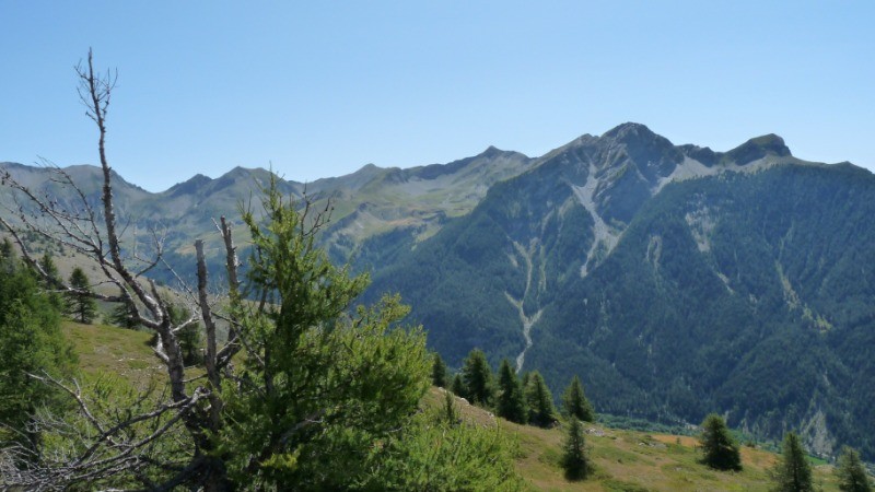
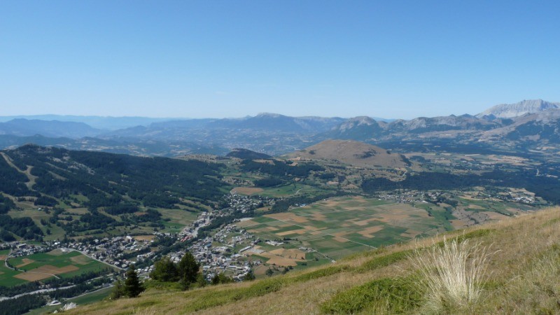
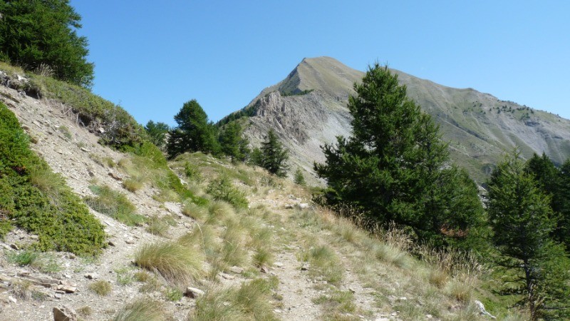
Beau temps pour cette agréable boucle au départ d'Ancelle par un large chemin Pierreux puis sentier en pente régulière jusqu'au sommet du Cuchon (2002m) ou la vue est belle sur les sommets et massifs environnants. La descente se fait par les pistes de ski de la petite station vers Saint Léger-les-Mélézes puis retour vers Ancelle Village par le GR 50
 Actions
13.3 km

+659 m
/-661 m
04:40

Cliquez pour activer


Cliquez et déplacez la souris sur le profil pour analyser un tronçon (2 doigts sur mobile)
 Photos
Commentaires

Par
lbbranet le 23.08.22 14:48
L'aller jusqu'au Cuchon est superbe. Par contre, il faut redescendre par le même chemin car le retour par les pistes de ski ne valent pas le coup. Il s'agit d'un grand chemin en pierres dans la forêt, et surtout la boucle se termine par 2 km de route, donc aucun intérêt. Il vaut donc mieux faire l'aller-retour d'Ancelle jusqu'au Cuchon, le panorama est superbe.
Connectez-vous pour ajouter un commentaire
Longueur et nombre de points

13.34 km

1322 pts
Denivelé et altitude
Calculés sans seuil et un lissage sur 5 points

658 m

662 m

1982 m

1348 m

1638 m
Date et durée

14 août 2019
09:08

14 août 2019
15:34

06:25:51

04:40:42

01:45:09
Vitesses et denivelés horaires

2.9 km/h
Détail »

5.1 km/h
au km 1.5

254 m/h
2h27m52s

-379 m/h
1h37m46s
| km | Temps | Vitesse | Pause |
|---|
| 1 | 17'48" | 3.4 km/h | |
| 2 | 15'49" | 3.8 km/h | |
| 3 | 16'46" | 3.6 km/h | 02'38" |
| 4 | 18'48" | 3.2 km/h | |
| 5 | 29'49" | 2 km/h | 04'40" |
| 6 | 22'01" | 2.7 km/h | 04'46" |
| 7 | 25'54" | 2.3 km/h | 11'37" |
| 8 | 20'55" | 2.9 km/h | 06'41" |
| 9 | 24'40" | 2.4 km/h | 62'17" |
| 10 | 23'59" | 2.5 km/h | 05'03" |
| 11 | 23'05" | 2.6 km/h | 06'13" |
| 12 | 20'34" | 2.9 km/h | |
| 13 | 14'03" | 4.3 km/h | |
Dépense calorique (estimation)

495 Cal
106 Cal/h
Plus

Affichée 2165 fois et téléchargée 135 fois depuis le 28.08.19 11:36
KME
22.1 kilomètres effort
Carte + Profil [Afficher un aperçu]
<iframe src="https://www.visugpx.com/dD0oTJdnXP?iframe" allowfullscreen style="border: 0;width: 100%; height: 540px;" loading="lazy" scrolling="no"></iframe>
Carte uniquement [Afficher un aperçu]
<iframe src="https://www.visugpx.com/dD0oTJdnXP?iframe&maponly" allowfullscreen style="border: 0;width: 100%; height: 540px;" loading="lazy" scrolling="no"></iframe>

 ForumsToposLes plus belles randosSegments
 Offre Premium
 Connexion


 76
76 155
155 45 [Légende]


