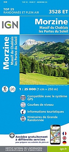
Départ Abondance parking le Sauvage; à gauche vers le col de la Plagne puis direction Ubine (joli village, chapelle) - col d'Ubine - chalet de Mens - direction chalets de Chevenne, bifurquer à droite 15mn avant le lieudit Chevenne en direction de La Raille(montée assez forte), arrivée au chalet de La Raille et retour par le chemin jeepable au parking.
Belle randonnée avec paysages variés.
 Actions
12 km

+842 m/-837 m

04:45

Cliquez pour activer


Cliquez et déplacez la souris sur le profil pour analyser un tronçon (2 doigts sur mobile)
Commentaires
Pas encore de commentaire, connectez-vous pour en ajouter un.
Connectez-vous pour ajouter un commentaire
Longueur et nombre de points

12.21 km

1380 pts

25 marqueurs
Denivelé et altitude
Calculés avec un seuil de 10 mètres et un lissage sur 5 points

841 m

837 m

1699 m

1235 m

1491 m
Date et durée

29 juillet 2016
08:48

29 juillet 2016
16:40

07:52:04

04:45:34

03:06:30
Vitesses et denivelés horaires

2.6 km/h
Détail »

4.9 km/h
au km 5.4

299 m/h
2h41m36s

-431 m/h
1h49m22s
| km | Temps | Vitesse | Pause |
|---|
| 1 | 22'59" | 2.6 km/h | |
| 2 | 23'32" | 2.5 km/h | 03'07" |
| 3 | 25'25" | 2.4 km/h | |
| 4 | 24'35" | 2.4 km/h | 08'19" |
| 5 | 26'25" | 2.3 km/h | 02'24" |
| 6 | 28'41" | 2.1 km/h | 16'02" |
| 7 | 18'13" | 3.3 km/h | 104'03" |
| 8 | 16'56" | 3.5 km/h | 06'22" |
| 9 | 40'49" | 1.5 km/h | 13'29" |
| 10 | 19'18" | 3.1 km/h | 31'26" |
| 11 | 17'53" | 3.4 km/h | |
| 12 | 17'51" | 3.4 km/h | |
Dépense calorique (estimation)

709 Cal
149 Cal/h
Plus

Affichée 1066 fois et téléchargée 92 fois depuis le 07.04.20 15:25
Carte + Profil [Afficher un aperçu]
<iframe src="https://www.visugpx.com/bXIk15iRqV?iframe" allowfullscreen style="border: 0;width: 100%; height: 540px;" scrolling="no"></iframe>
Carte uniquement [Afficher un aperçu]
<iframe src="https://www.visugpx.com/bXIk15iRqV?iframe&maponly" allowfullscreen style="border: 0;width: 100%; height: 540px;" scrolling="no"></iframe>

Nous avons pris en compte votre choix.
Vous souhaitez maîtriser les informations qui peuvent être recueillies lors de votre navigation et avez refusé les cookies de personnalisation des annonces, c'est légitime.
Parce que le service fourni par VisuGPX a un coût, accepteriez-vous quand même que nous utilisions des cookies pour vous présenter des annonces non personnalisées ? Ces cookies ne sont pas des cookies de tracking mais de simples des cookies techniques de diffusion qui garantissent le respect votre vie privée.


 Actions
  12 km
12 km +842 m/-837 m
 04:45
04:45

 Cliquez et déplacez la souris sur le profil pour analyser un tronçon (2 doigts sur mobile)
 100
100 230
230 121 [Légende]
 Pour soutenir VisuGPX, faites le bon choix