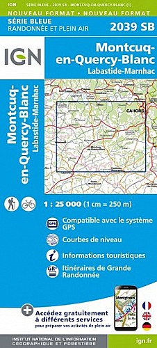
Au départ de la gendarmerie, boucle en deux partie l'une qui monte à Pélis et redescend par le Balcon du Lot et l'autre qui emprunte le GR 36 qui longe le Lot (dit le Pesquier) pour gagner St Vincent Rive d'Olt . Retour à Luzech pat Lémouzy
 Actions
13 km

+315 m/-322 m

03:00

Cliquez pour activer


Cliquez et déplacez la souris sur le profil pour analyser un tronçon (2 doigts sur mobile)
 Photos
Commentaires
Pas encore de commentaire, connectez-vous pour en ajouter un.
Connectez-vous pour ajouter un commentaire
Longueur et nombre de points

12.78 km

886 pts
Denivelé et altitude
Calculés avec un seuil de 10 mètres et un lissage sur 5 points

314 m

322 m

304 m

86 m

158 m
Date et durée

25 janvier 2018
08:49

25 janvier 2018
12:15

03:26:30

03:07:21

00:19:09
Vitesses et denivelés horaires

4.1 km/h
Détail »

6 km/h
au km 2.4

281 m/h
0h59m43s

-294 m/h
0h58m27s
| km | Temps | Vitesse | Pause |
|---|
| 1 | 13'41" | 4.4 km/h | 02'52" |
| 2 | 19'32" | 3.1 km/h | |
| 3 | 15'33" | 3.9 km/h | |
| 4 | 15'26" | 3.9 km/h | |
| 5 | 13'31" | 4.4 km/h | 09'24" |
| 6 | 13'18" | 4.5 km/h | |
| 7 | 14'53" | 4 km/h | |
| 8 | 13'51" | 4.3 km/h | |
| 9 | 12'36" | 4.8 km/h | |
| 10 | 14'39" | 4.1 km/h | 06'53" |
| 11 | 16'55" | 3.5 km/h | |
| 12 | 12'59" | 4.6 km/h | |
Dépense calorique (estimation)

424 Cal
136 Cal/h
Plus

Affichée 857 fois et téléchargée 37 fois depuis le 25.01.18 15:31
Carte + Profil [Afficher un aperçu]
<iframe src="https://www.visugpx.com/Yik8jUT89X?iframe" allowfullscreen style="border: 0;width: 100%; height: 540px;" scrolling="no"></iframe>
Carte uniquement [Afficher un aperçu]
<iframe src="https://www.visugpx.com/Yik8jUT89X?iframe&maponly" allowfullscreen style="border: 0;width: 100%; height: 540px;" scrolling="no"></iframe>


Nous avons pris en compte votre choix.
Vous souhaitez maîtriser les informations qui peuvent être recueillies lors de votre navigation et avez refusé les cookies de personnalisation des annonces, c'est légitime.
Parce que le service fourni par VisuGPX a un coût, accepteriez-vous quand même que nous utilisions des cookies pour vous présenter des annonces non personnalisées ? Ces cookies ne sont pas des cookies de tracking mais de simples des cookies techniques de diffusion qui garantissent le respect votre vie privée.


 Actions
  13 km
13 km +315 m/-322 m
 03:00
03:00

 Cliquez et déplacez la souris sur le profil pour analyser un tronçon (2 doigts sur mobile)


 44
44 73
73 27 [Légende]

 Pour soutenir VisuGPX, faites le bon choix