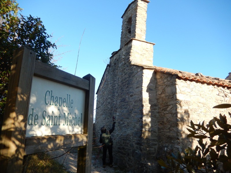
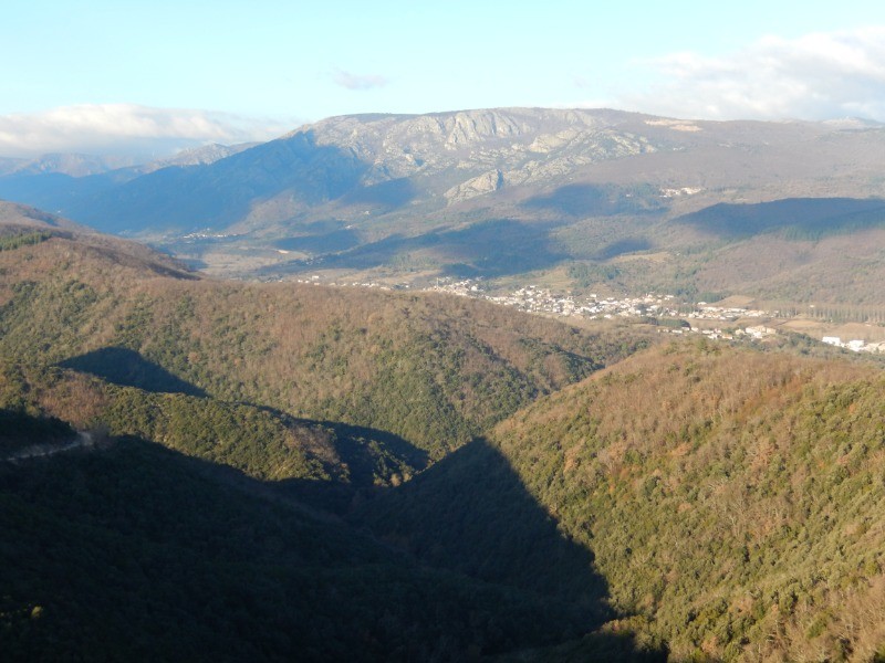
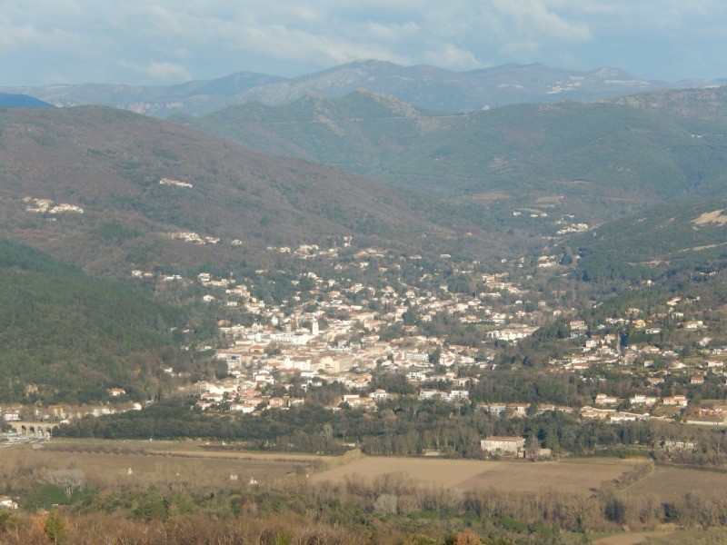
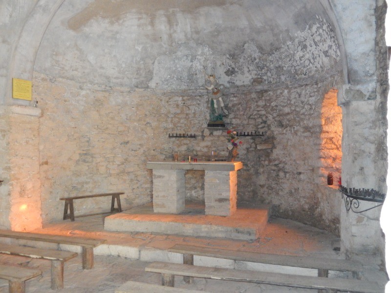
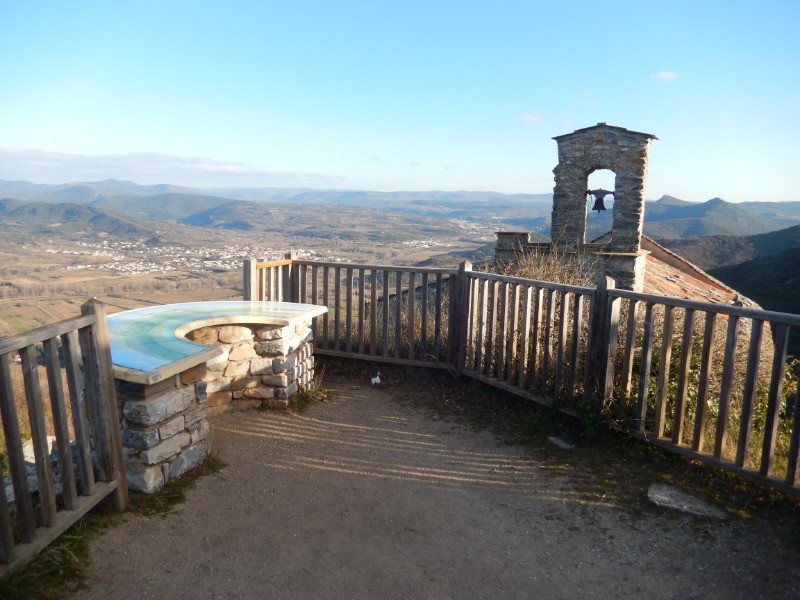
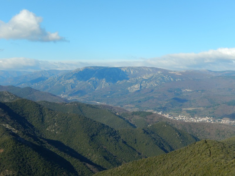
Au départ du village des Aires (34), une sympathique rando balisée en jaune (PR) à travers une très belle forêt de chêne vert, avec étape aux ruines du château et à la chapelle St Michel, et de magnifiques points de vue sur la vallée de l'Orb, l'Espinouse et le Caroux, ainsi que sur toute la plaine biterroise.
 Actions
12.1 km

+656 m
/-665 m
03:27

Cliquez pour activer


Cliquez et déplacez la souris sur le profil pour analyser un tronçon (2 doigts sur mobile)
 Photos
Commentaires
Pas encore de commentaire, connectez-vous pour en ajouter un.
Connectez-vous pour ajouter un commentaire
Longueur et nombre de points

12.09 km

2091 pts
Denivelé et altitude
Calculés avec un seuil de 10 mètres et un lissage sur 5 points

655 m

666 m

709 m

180 m

438 m
Date et durée

10 janvier 2019
08:56

10 janvier 2019
13:51

04:54:31

03:27:53

01:26:38
Vitesses et denivelés horaires

3.5 km/h
Détail »

6.9 km/h
au km 6.5

335 m/h
1h52m45s

-519 m/h
1h12m40s
| km | Temps | Vitesse | Pause |
|---|
| 1 | 17'37" | 3.4 km/h | |
| 2 | 17'41" | 3.4 km/h | 03'00" |
| 3 | 15'05" | 4 km/h | |
| 4 | 25'00" | 2.4 km/h | 23'12" |
| 5 | 20'43" | 2.9 km/h | 01'56" |
| 6 | 21'40" | 2.8 km/h | 03'51" |
| 7 | 16'22" | 3.7 km/h | 41'35" |
| 8 | 17'40" | 3.4 km/h | |
| 9 | 12'47" | 4.7 km/h | 04'48" |
| 10 | 13'37" | 4.4 km/h | |
| 11 | 13'52" | 4.3 km/h | 04'51" |
| 12 | 14'31" | 4.1 km/h | 03'25" |
Dépense calorique (estimation)

632 Cal
182 Cal/h
Plus

Affichée 1293 fois et téléchargée 106 fois depuis le 07.04.20 15:25
KME
20.9 kilomètres effort
Carte + Profil [Afficher un aperçu]
<iframe src="https://www.visugpx.com/Y5y44JmjF4?iframe" allowfullscreen style="border: 0;width: 100%; height: 540px;" loading="lazy" scrolling="no"></iframe>
Carte uniquement [Afficher un aperçu]
<iframe src="https://www.visugpx.com/Y5y44JmjF4?iframe&maponly" allowfullscreen style="border: 0;width: 100%; height: 540px;" loading="lazy" scrolling="no"></iframe>


 ForumsToposLes plus belles randosSegments
 Offre Premium
 Connexion


 73
73 159
159 89 [Légende]


