Aux portes de Brocéliande, la mythique forêt de Paimpont offre plus de 200 km de sentiers menant à des lieux emblématiques comme le tombeau de Merlin ou le Val sans Retour... Cette randonnée au départ de Concoret relie campagne et lisière de forêt, entre villages et chemins légendaires.
Départ : parking salle de l'étoile
 Actions
29.2 km

+376 m
/-376 m
±08:15

Cliquez pour activer

Cliquez et déplacez la souris sur le profil pour analyser un tronçon (2 doigts sur mobile)
Détails
A voir sur le parcours :
- le château de Comper, une ancienne place forte de Bretagne
- le bois de Trékouet
- les roches de Tréban
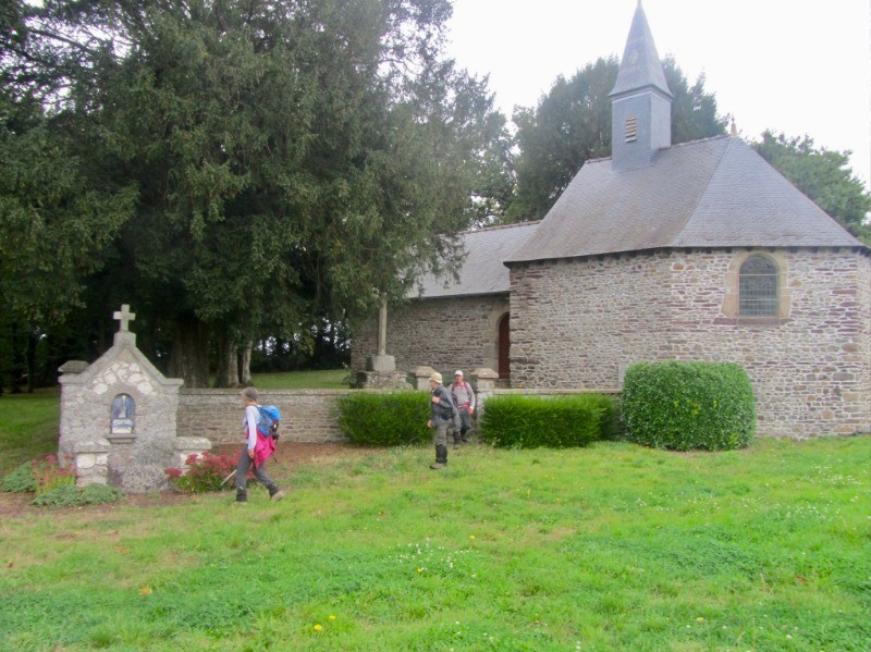
- la chapelle de Beuve dans le village de la ville Damon
- la Croix Fallié
- la Fontaine de Barenton
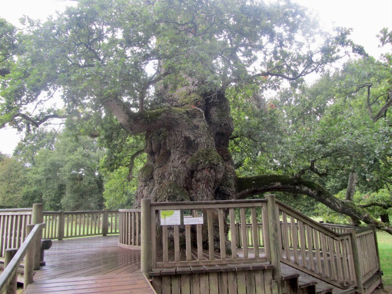
- le chêne à Guillotin, un arbre remarquable
- le bourg de Concoret
Le château de Comper :
www.broceliande-vacances.com/decouvrir/incontournables/foret-broceliande/visiter/centre-de-limaginaire-arthurien/
La forêt de Brocéliande :
www.tourismebretagne.com/destinations/les-10-destinations/destination-broceliande/la-foret-de-broceliande/
Site internet de Félix35 :
www.au-fil-des-sentiers.fr/ Photos
Commentaires
Pas encore de commentaire, connectez-vous pour en ajouter un.
Connectez-vous pour ajouter un commentaire
Longueur et nombre de points

29.16 km

4228 pts

1 marqueur
Denivelé et altitude
Calculés avec un seuil de 5 mètres et un lissage sur 3 points

375 m

376 m

188 m

67 m

105 m
Plus

Affichée 1729 fois et téléchargée 79 fois depuis le 18.10.19 12:03
KME
34.2 kilomètres effort
Carte + Profil [Afficher un aperçu]
<iframe src="https://www.visugpx.com/Nw1CUAzlgL?iframe" allowfullscreen style="border: 0;width: 100%; height: 540px;" loading="lazy" scrolling="no"></iframe>
Carte uniquement [Afficher un aperçu]
<iframe src="https://www.visugpx.com/Nw1CUAzlgL?iframe&maponly" allowfullscreen style="border: 0;width: 100%; height: 540px;" loading="lazy" scrolling="no"></iframe>


 ForumsToposLes plus belles randosSegments
 Offre Premium
 Connexion


 Concoret, vers la forêt de Brocéliande

 74
74 109
109 20 [Légende]


