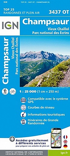
départ Ancelle, petit parking en rive gauche, poursuivre jusqu'au petit pont de bois à traverser et continuer en rive droite jusqu'au carrefour indiquant "Le Cuchon". grimper par le sentier caillouteux jusqu'au sommet à 2000 m environ et poursuivre en face par la sente qui monte jusqu'aux dents d'Autane. Passage câblé et parfois vertigineux . Redescendre par le sentier qui mène à la cabane des gardes puis prendre le GR 50 jusqu'au retour à Ancelle
 Actions
16 km

+881 m/-879 m

05:30

Cliquez pour activer


Cliquez et déplacez la souris sur le profil pour analyser un tronçon (2 doigts sur mobile)
Commentaires
Pas encore de commentaire, connectez-vous pour en ajouter un.
Connectez-vous pour ajouter un commentaire
Longueur et nombre de points

15.95 km

2243 pts
Denivelé et altitude
Calculés avec un seuil de 10 mètres et un lissage sur 5 points

881 m

880 m

2198 m

1346 m

1682 m
Date et durée

12 juin 2019
08:15

12 juin 2019
16:02

07:47:44

05:25:05

02:22:39
Vitesses et denivelés horaires

2.9 km/h
Détail »

5.6 km/h
au km 13.4

318 m/h
2h36m17s

-440 m/h
1h56m02s
| km | Temps | Vitesse | Pause |
|---|
| 1 | 14'53" | 4 km/h | 09'23" |
| 2 | 13'43" | 4.4 km/h | |
| 3 | 15'36" | 3.8 km/h | 04'29" |
| 4 | 19'49" | 3 km/h | |
| 5 | 23'27" | 2.6 km/h | 09'06" |
| 6 | 19'49" | 3 km/h | 12'55" |
| 7 | 20'40" | 2.9 km/h | |
| 8 | 26'14" | 2.3 km/h | 07'15" |
| 9 | 35'08" | 1.7 km/h | 23'34" |
| 10 | 30'05" | 2 km/h | 02'48" |
| 11 | 20'26" | 2.9 km/h | 04'48" |
| 12 | 19'38" | 3.1 km/h | 60'23" |
| 13 | 19'30" | 3.1 km/h | |
| 14 | 15'28" | 3.9 km/h | 07'25" |
| 15 | 14'19" | 4.2 km/h | |
Dépense calorique (estimation)

749 Cal
138 Cal/h
Plus

Affichée 687 fois et téléchargée 25 fois depuis le 07.04.20 15:25
Carte + Profil [Afficher un aperçu]
<iframe src="https://www.visugpx.com/LdDXnaKBcE?iframe" allowfullscreen style="border: 0;width: 100%; height: 540px;" scrolling="no"></iframe>
Carte uniquement [Afficher un aperçu]
<iframe src="https://www.visugpx.com/LdDXnaKBcE?iframe&maponly" allowfullscreen style="border: 0;width: 100%; height: 540px;" scrolling="no"></iframe>

Nous avons pris en compte votre choix.
Vous souhaitez maîtriser les informations qui peuvent être recueillies lors de votre navigation et avez refusé les cookies de personnalisation des annonces, c'est légitime.
Parce que le service fourni par VisuGPX a un coût, accepteriez-vous quand même que nous utilisions des cookies pour vous présenter des annonces non personnalisées ? Ces cookies ne sont pas des cookies de tracking mais de simples des cookies techniques de diffusion qui garantissent le respect votre vie privée.


 Actions
  16 km
16 km +881 m/-879 m
 05:30
05:30

 Cliquez et déplacez la souris sur le profil pour analyser un tronçon (2 doigts sur mobile)
 101
101 217
217 98 [Légende]
 Pour soutenir VisuGPX, faites le bon choix