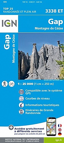
Un circuit au départ de La Roche des Arnauds qui nous fera passer par Corréo, puis descendre par le lac et près des vergers , traverser la D994 par un passage prévu au dessous, puis revenir vers le torrent du Rif de la Ville qu'il faudra traverser à gué avant de rejoindre le Hameau Les Allemands ( Manteyer) , puis suivre le GR94 et terminer par la D18.
 Actions
12 km

+263 m/-262 m

02:45

Cliquez pour activer


Cliquez et déplacez la souris sur le profil pour analyser un tronçon (2 doigts sur mobile)
Détails
voir rando 
Commentaires
Pas encore de commentaire, connectez-vous pour en ajouter un.
Connectez-vous pour ajouter un commentaire
Longueur et nombre de points

12.25 km

1097 pts
Denivelé et altitude
Calculés avec un seuil de 10 mètres et un lissage sur 5 points

263 m

263 m

1158 m

924 m

1005 m
Date et durée

12 novembre 2016
12:47

12 novembre 2016
15:40

02:52:47

02:52:04

00:00:43
Vitesses et denivelés horaires

4.3 km/h
Détail »

5.9 km/h
au km 6.2

341 m/h
0h40m02s

-287 m/h
0h44m01s
| km | Temps | Vitesse | Pause |
|---|
| 1 | 13'32" | 4.4 km/h | |
| 2 | 14'07" | 4.3 km/h | |
| 3 | 13'09" | 4.6 km/h | |
| 4 | 15'27" | 3.9 km/h | |
| 5 | 13'07" | 4.6 km/h | |
| 6 | 13'23" | 4.5 km/h | |
| 7 | 16'07" | 3.7 km/h | |
| 8 | 13'21" | 4.5 km/h | |
| 9 | 13'52" | 4.3 km/h | |
| 10 | 15'48" | 3.8 km/h | |
| 11 | 14'03" | 4.3 km/h | |
| 12 | 12'44" | 4.7 km/h | |
Dépense calorique (estimation)

346 Cal
121 Cal/h
Plus

Affichée 724 fois et téléchargée 46 fois depuis le 07.04.20 15:25
Carte + Profil [Afficher un aperçu]
<iframe src="https://www.visugpx.com/y607VFaMBm?iframe" allowfullscreen style="border: 0;width: 100%; height: 540px;" scrolling="no"></iframe>
Carte uniquement [Afficher un aperçu]
<iframe src="https://www.visugpx.com/y607VFaMBm?iframe&maponly" allowfullscreen style="border: 0;width: 100%; height: 540px;" scrolling="no"></iframe>

Nous avons pris en compte votre choix.
Vous souhaitez maîtriser les informations qui peuvent être recueillies lors de votre navigation et avez refusé les cookies de personnalisation des annonces, c'est légitime.
Parce que le service fourni par VisuGPX a un coût, accepteriez-vous quand même que nous utilisions des cookies pour vous présenter des annonces non personnalisées ? Ces cookies ne sont pas des cookies de tracking mais de simples des cookies techniques de diffusion qui garantissent le respect votre vie privée.


 Actions
  12 km
12 km +263 m/-262 m
 02:45
02:45

 Cliquez et déplacez la souris sur le profil pour analyser un tronçon (2 doigts sur mobile)

 41
41 68
68 24 [Légende]
 Pour soutenir VisuGPX, faites le bon choix