Balade très agréable entre les vignes et dans les bois.
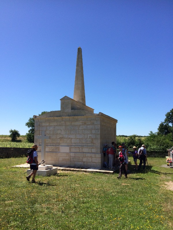
A voir, le vieux châteaux de Dardenac,en ruine, et un peu plus loin, la tombe monumentale du Général Vicomte Toussaint D'Armagnac (époque napoléonienne).
Impossibilité d'accéder au plan d'eau d'Espiet, ancienne carrière, domaine privé et propriétaire pas du tout accueillant .
 Actions
13.8 km

+154 m
/-148 m
03:28

Cliquez pour activer


Cliquez et déplacez la souris sur le profil pour analyser un tronçon (2 doigts sur mobile)
 Photos
Commentaires

Par
Sylvestre33 le 23.03.21 11:48
Bonjour Kerhelen, très honnêtement, je ne me souviens plus des détails de cette balade... j'avais mis ce commentaire "à chaud", je n'aime pas trop les routes, mais parfois ce sont de petites routes avec très peu de circulation, et je trouve ça tout à fait tolérable. Désolé de ne pouvoir être plus précis.
SC
Par
Kerhelen le 22.03.21 20:12
Bonjour,
Malgré votre description (Balade très agréable entre les vignes et dans les bois), quand je regarde la carte IGN j'ai l'impression qu'il y a pas mal de routes tout de même. Je me trompe ?
Merci pour votre réponse.
Kerhelen
Connectez-vous pour ajouter un commentaire
Longueur et nombre de points

13.83 km

1179 pts
Denivelé et altitude
Calculés avec un seuil de 10 mètres et un lissage sur 5 points

154 m

148 m

79 m

30 m

60 m
Date et durée

18 juin 2017
08:53

18 juin 2017
12:59

04:06:09

03:28:37

00:37:32
Vitesses et denivelés horaires

4 km/h
Détail »

5.6 km/h
au km 0.7

174 m/h
0h22m14s

-202 m/h
0h31m47s
| km | Temps | Vitesse | Pause |
|---|
| 1 | 13'30" | 4.4 km/h | 08'15" |
| 2 | 13'47" | 4.4 km/h | |
| 3 | 18'06" | 3.3 km/h | |
| 4 | 14'42" | 4.1 km/h | |
| 5 | 14'41" | 4.1 km/h | |
| 6 | 17'36" | 3.4 km/h | 02'08" |
| 7 | 16'28" | 3.6 km/h | 12'45" |
| 8 | 14'19" | 4.2 km/h | |
| 9 | 17'43" | 3.4 km/h | 02'00" |
| 10 | 13'59" | 4.3 km/h | 07'36" |
| 11 | 14'09" | 4.2 km/h | |
| 12 | 13'26" | 4.5 km/h | 03'05" |
| 13 | 15'10" | 4 km/h | |
Dépense calorique (estimation)

289 Cal
83 Cal/h
Plus

Affichée 2215 fois et téléchargée 137 fois depuis le 17.06.17 18:51
KME
15.9 kilomètres effort
Carte + Profil [Afficher un aperçu]
<iframe src="https://www.visugpx.com/vBPhtjVsql?iframe" allowfullscreen style="border: 0;width: 100%; height: 540px;" loading="lazy" scrolling="no"></iframe>
Carte uniquement [Afficher un aperçu]
<iframe src="https://www.visugpx.com/vBPhtjVsql?iframe&maponly" allowfullscreen style="border: 0;width: 100%; height: 540px;" loading="lazy" scrolling="no"></iframe>


 ForumsToposLes plus belles randosSegments
 Offre Premium
 Connexion


 37
37 55
55 15 [Légende]


