Boucle refaite à VTT en grande partie le 07 Février 2020. Mais chemins trop boueux en cette saison, et surtout pas mal défoncés par les engins de chantiers.
Boucle re-refaite le 14 juillet 2017 avec Hamid en un peu moins de 3 heures. Toujours autant de plaisir à le suivre. Mais c'est quand même mieux avec le beau temps !
Boucle refaite à VTT le 17 février 2017 avec JP et Robert. Dénivelé relevé à 958 m. J'en profite pour corriger quelques erreurs faitent lors du 1er traçage du circuit. On devrait être pas loin de la perfection au niveau du guidage GPS. Dites moi ce que vous en pensez !!
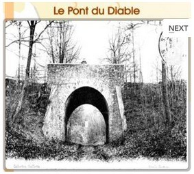
Boucle réalisée à VTT le 23 avril 2015 en compagnie de Robert et Gilles en 3h40. Très beau parcours mais attention au dénivelé : 847 m relevé. Quelque fois, il faut un peu chercher le sentier car la nature reprends ses droits. C'est long mais que de belles surprises !! A voir ...
Connectez-vous pour ajouter un commentaire
Longueur et nombre de points
30.86 km
932 pts
Denivelé et altitude
Calculés avec un seuil de 10 mètres et un lissage sur 5 points
579 m
581 m
190 m
76 m
144 m
Plus
Affichée 8613 fois et téléchargée 969 fois depuis le 07.04.20 15:25
En cliquant sur "accepter" vous autorisez l'utilisation de cookies à usage technique nécessaires au bon fonctionnement du site, ainsi que l'utilisation d'autres cookies (éventuellement tiers) à des fins statistiques ou de personnalisation des annonces pour vous proposer des services et des offres adaptées à vos centres d'interêt.
Vous pouvez à tout moment modifier ce choix ou obtenir des informations sur ces cookies sur la page des conditions générales d'utilisation du service :
 ForumsToposLes plus belles randosSegments
 Offre Premium
 Connexion


 97
97 173
173 66 [Légende]


 30.9 km
 +
+ ±03:30