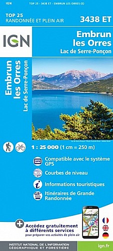
Belle randonnée sans difficulté. La montée après la piste forestière est un peu raide, mais se fait sans problème. Le retour par le lac de saint-Apollinaire est plus sympa que la route forestière de Joubelle, il y a juste un petit raidillon pour remonter sur le parking sans prendre la route.
 Actions
8 km

+540 m/-526 m

03:15

Cliquez pour activer


Cliquez et déplacez la souris sur le profil pour analyser un tronçon (2 doigts sur mobile)
Commentaires
Pas encore de commentaire, connectez-vous pour en ajouter un.
Connectez-vous pour ajouter un commentaire
Longueur et nombre de points

8.17 km

2493 pts
Denivelé et altitude
Calculés avec un seuil de 5 mètres et un lissage sur 5 points

539 m

526 m

1941 m

1454 m

1641 m
Date et durée

07 janvier 2021
10:35

07 janvier 2021
15:02

04:27:49

03:19:53

01:07:56
Vitesses et denivelés horaires

2.5 km/h
Détail »

4 km/h
au km 4.7

270 m/h
1h48m48s

-437 m/h
1h07m39s
| km | Temps | Vitesse | Pause |
|---|
| 1 | 20'58" | 2.9 km/h | 04'36" |
| 2 | 32'09" | 1.9 km/h | 19'56" |
| 3 | 26'25" | 2.3 km/h | 07'36" |
| 4 | 21'02" | 2.9 km/h | 28'50" |
| 5 | 23'13" | 2.6 km/h | 02'11" |
| 6 | 21'33" | 2.8 km/h | 04'47" |
| 7 | 21'54" | 2.7 km/h | |
| 8 | 29'07" | 2.1 km/h | |
Dépense calorique (estimation)

451 Cal
135 Cal/h
Plus

Affichée 231 fois et téléchargée 12 fois depuis le 14.01.21 17:40
Carte + Profil [Afficher un aperçu]
<iframe src="https://www.visugpx.com/kvsRARMmt9?iframe" allowfullscreen style="border: 0;width: 100%; height: 540px;" scrolling="no"></iframe>
Carte uniquement [Afficher un aperçu]
<iframe src="https://www.visugpx.com/kvsRARMmt9?iframe&maponly" allowfullscreen style="border: 0;width: 100%; height: 540px;" scrolling="no"></iframe>

Nous avons pris en compte votre choix.
Vous souhaitez maîtriser les informations qui peuvent être recueillies lors de votre navigation et avez refusé les cookies de personnalisation des annonces, c'est légitime.
Parce que le service fourni par VisuGPX a un coût, accepteriez-vous quand même que nous utilisions des cookies pour vous présenter des annonces non personnalisées ? Ces cookies ne sont pas des cookies de tracking mais de simples des cookies techniques de diffusion qui garantissent le respect votre vie privée.


 Actions
  8 km
8 km +540 m/-526 m
 03:15
03:15

 Cliquez et déplacez la souris sur le profil pour analyser un tronçon (2 doigts sur mobile)
 68
68 145
145 50 [Légende]
 Pour soutenir VisuGPX, faites le bon choix