Boucle des Polissoirs à Faÿ-les-Nemours
Remontez le temps à la découverte des polissoirs.
Les polissoirs c’est quoi ? : Ce sont des roches abrasives comme le grès de notre région (dit grès de Fontainebleau, grès stampien) que l’homme du néolithique (- 5 500 à – 1 800 ans avant notre ère en Europe) a utilisées pour polir des outils taillés dans du silex ou du grès très dur. Les traces laissées par le polissage sont encore visible de nos jours, sillons, cuvettes, zones polie. (L’inventaire a été dressé par Mr Bernard Theret.)
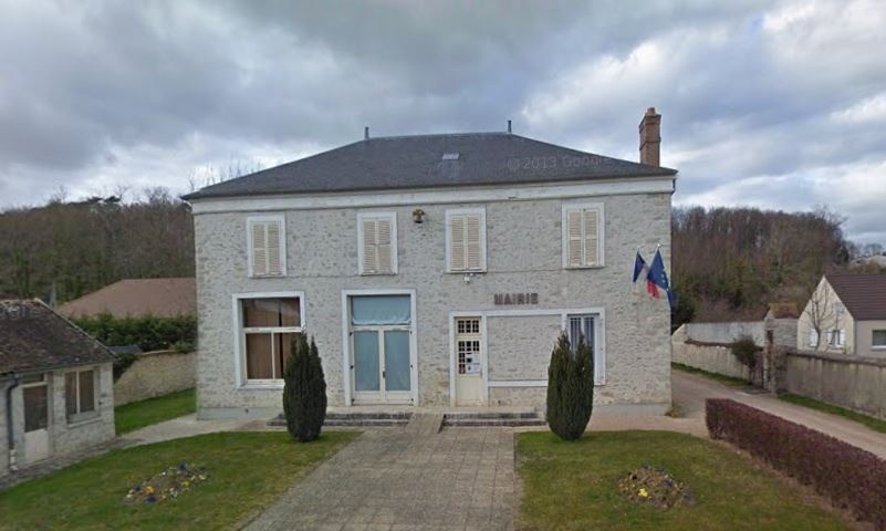
Le départ du circuit se situe sur le parking en face de la Mairie (30 rue Grande) au niveau du panneau d’information dédié au patrimoine de Faÿ-lès-Nemours.
 Actions
11.7 km

+130 m
/-130 m
±03:15

Cliquez pour activer

Cliquez et déplacez la souris sur le profil pour analyser un tronçon (2 doigts sur mobile)
Détails
Parcours et découverte
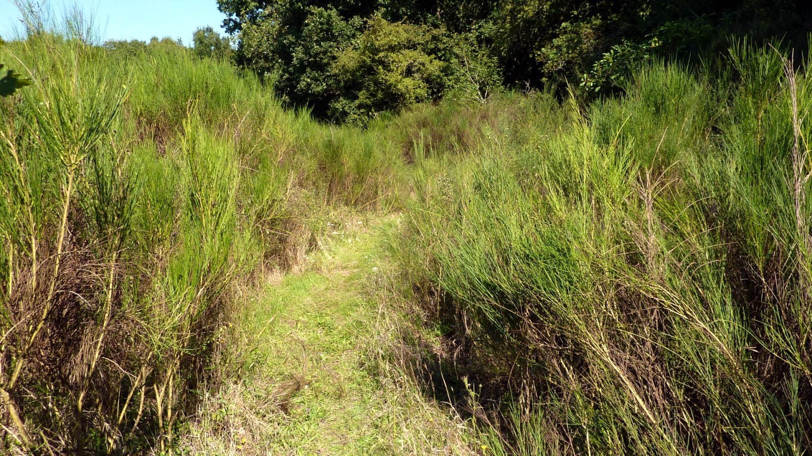
A - 40 m après le départ, tourner à droite, pour suivre Le Chemin des Postes. Continuer tout droit sur le PR et suivre la balisage jaune. Tourner à droite, puis de nouveau Tourner à droite Vous arrivez sur la Rue du Château-Landon, empruntez cette petite route sur 400 m en direction du Nord. Pour votre sécurité il est recommandé de marcher sur le côté gauche de cette chaussée étroite et en courbe afin de voir venir les voitures. Tourner à gauche Avant le hangar, tourner à gauche au niveau du parking goudronné. Suivez le petit sentier qui monte dans le sous-bois sur 270 m(Sentier des vignes de Laveaux).
Rester à droite du champ Contourner le champ, puis sur votre droite découvrez les deux
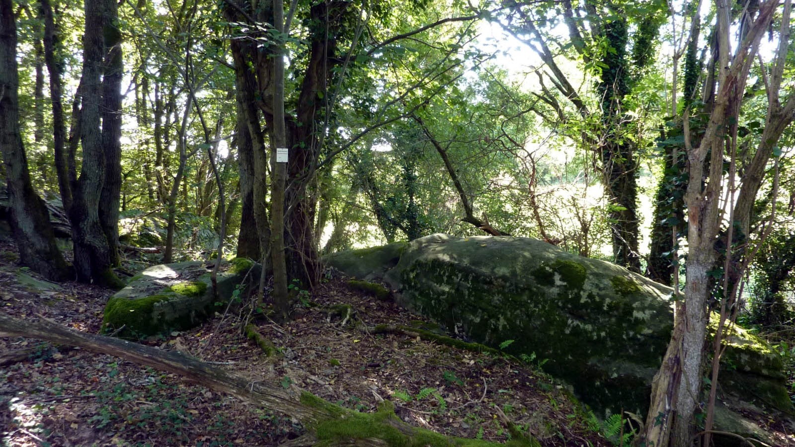
polissoirs du Cassis (un poteau balise les indique A).
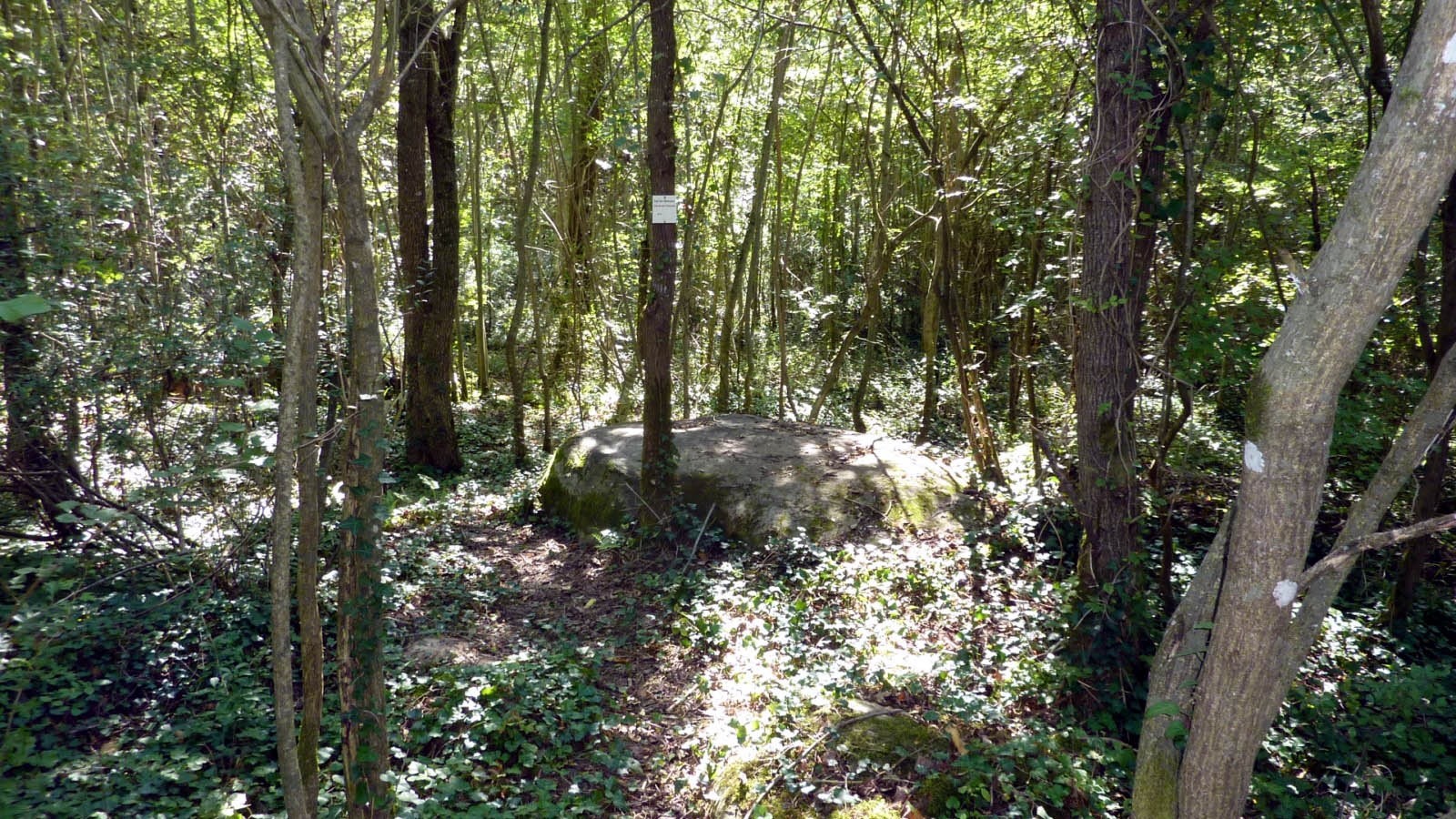
1 - POLISSOIRS DU CASSIS : Vous apercevrez juste en lisière de bois au bord du sentier (côté ouest), les deux polissoirs du Cassis. Une balise sur poteau les indique.
Puis longer le champ sur 100 m, et emprunter le chemin à droite dans le bois. Vous apercevrez une
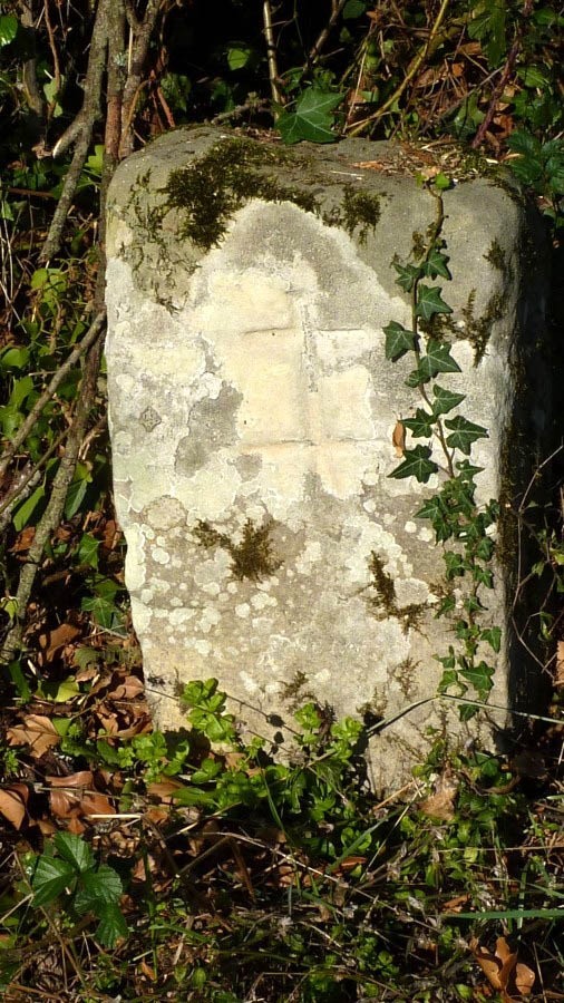
borne armoirée d’une croix de lorraine (B).
B1 - BORNE 2 : Borne armoirée d’une croix de lorraine.
Tourner à gauche Suivre sur votre gauche le balisage jaune (PR) pour continuer sur la Grande boucle. Possibilité de bifurquer à droite sur la Petite Boucle. Tourner à droite Faire 500 m puis tourner à droite, suivre balisage jaune. Prendre à gauche pour voir les 3 sites de polissoirs en aller-retour : N°2 :
Le Bois de la Grande Vente n°1 (C) à 200 m N°3 :
Le Bois de la Grande Vente n°2 (D) à 400 m N°4 : Le Bois de Laveau n°1 (E) à 570 m De retour des 3 sites , à l'intersection (10) prendre le chemin à gauche (balisage jaune
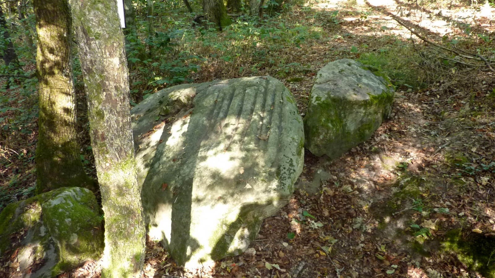
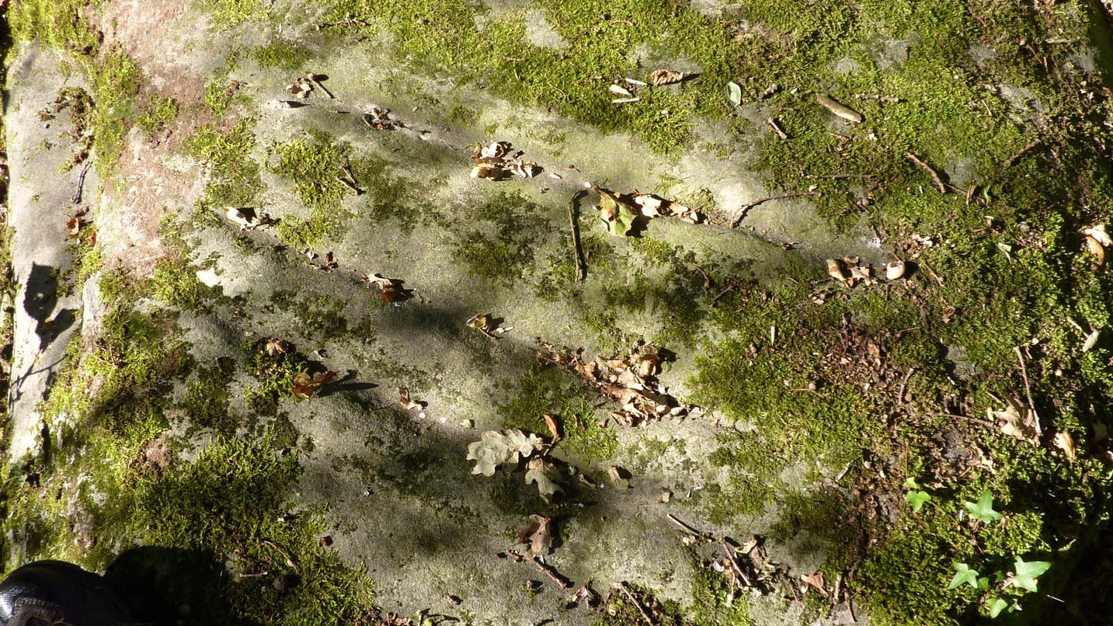
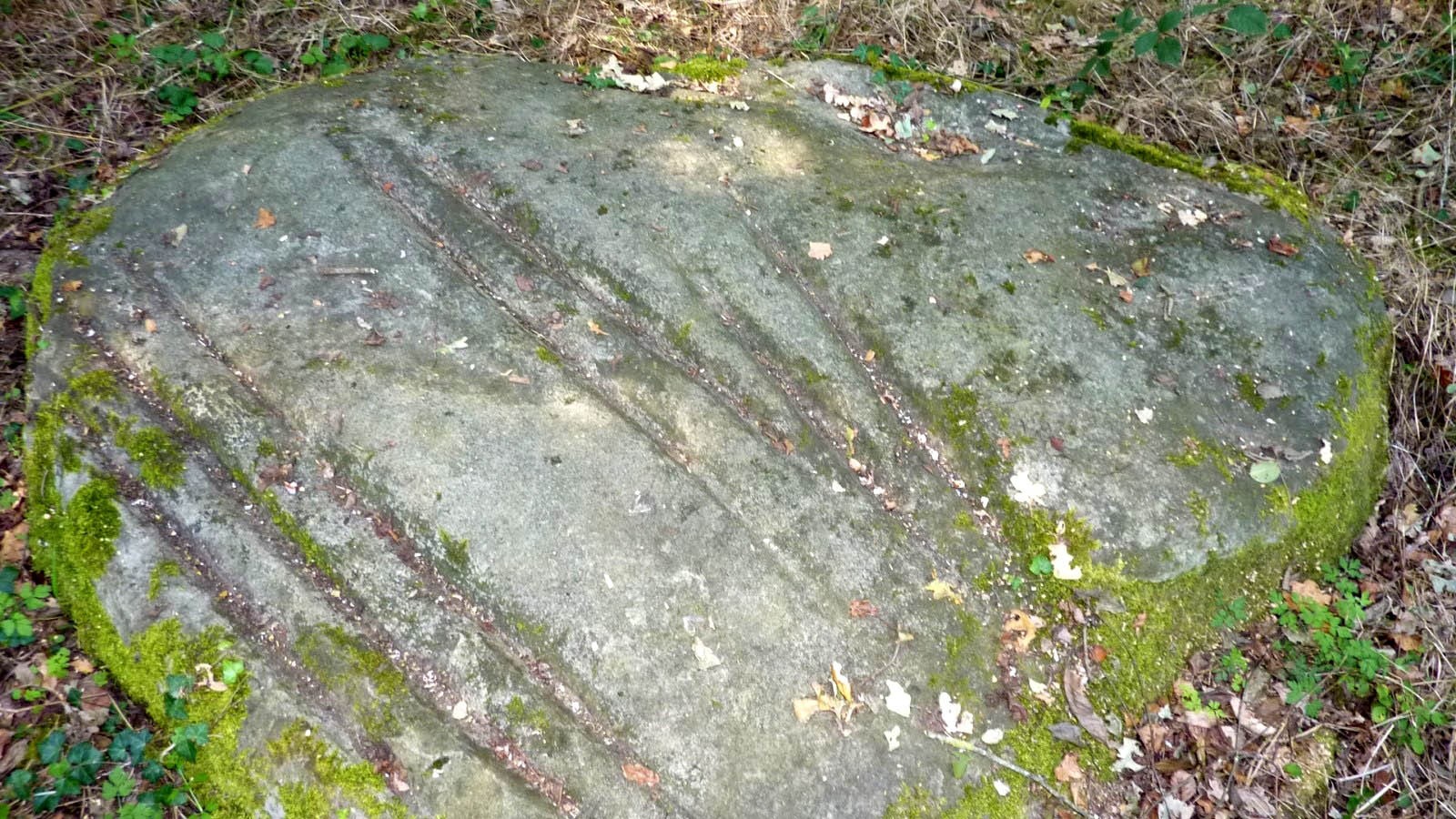
2 - Polissoir du Bois de la Grande Vente : Roche en forme de dôme de 1,3 par 1,2 m, haute de 0,6 m.Sur la face inclinée (70°) au sud on trouve 5 formes de sillons parallèles. Seules 3 d’entre eux portent de petites traces de polissage.
3 - Polissoir du Bois Laveau N°1 : Egalement connu sous le nom de :polissoir de Maison Rouge.Bloc en forme de cœur de 2,1 par 1,9 m, haut de 0,5 m, il porte 12 sillons, 2 cuvettes et 7 zones polies. 6 sillons ont été mutilés2 sillons font 1,18 m de long, ce sont les plus longs connus !
4 - POLISSOIR DU BOIS DE LA GRANDE VENTE : Roche oblongue sub-horizontale en grès peu induré.Elle porte 8 sillons. Il ne subsiste que de fines traces de polissage dans les sillons.Au centre du bloc une fissure, reliquat du passage des carriers dans la région. Suivre tout droit Suivre la route goudronnée. Pour arriver à la Ferme des Laveaux. Prendre à gauche Traverser la route pour rejoindre la Ferme de Laveaux
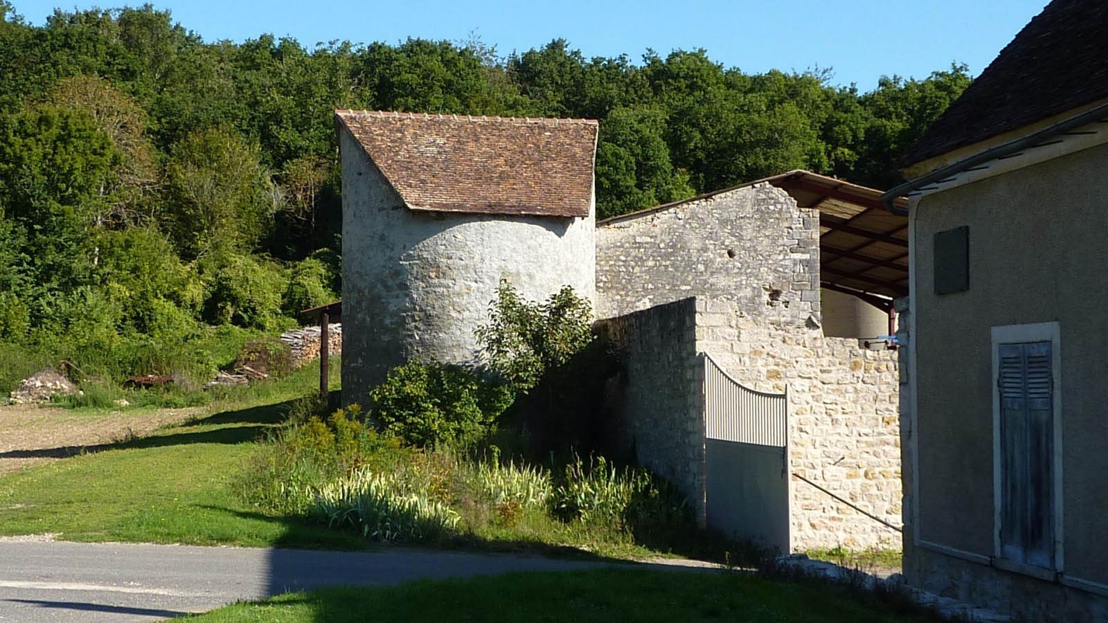
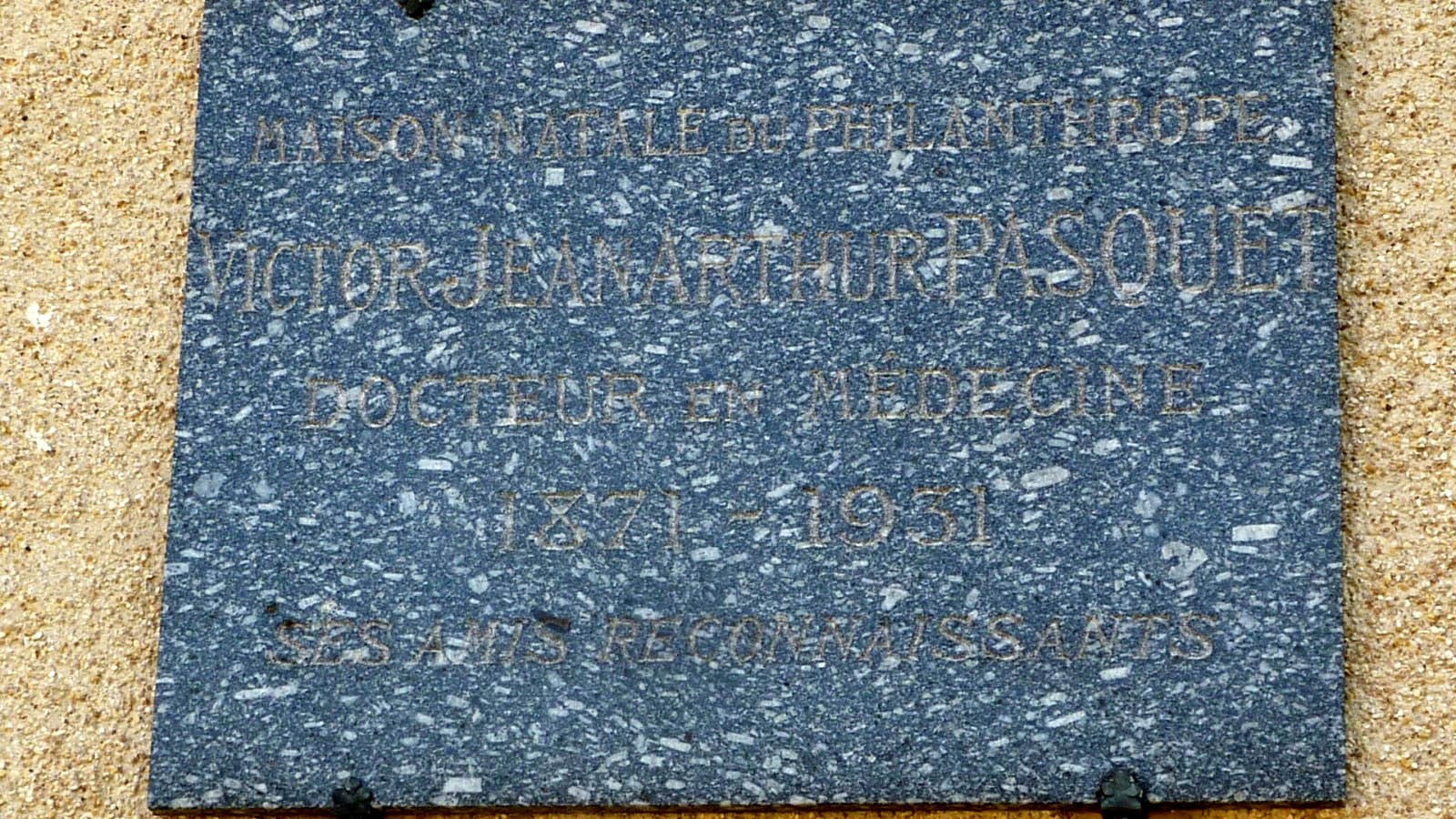
Ferme Lavaux ou LA FERME DE LAVEAUX : Laveaux, seul hameau de la commune de Faÿ bâti au fond d’un vallon, a été autrefois un prieuré-cure possédé par des religieux.
C’est dans cette ferme qu’est né en 1871 Victor Jean Arthur Pasquet docteur en médecine « celui qui sans compter mit sa vie au service de la souffrance humaine ». Une plaque située sur le mur de la ferme en témoigne et à Nemours à l’angle de la rue Gambetta et de la rue du Docteur Dumée on peut voir le monument qui a été érigé, par souscription publique, en hommage à ce philanthrope.
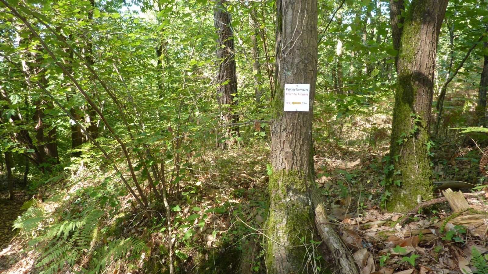
Intersection En face,à 20 m, se trouve une aire de pique-nique aménagée avec 2 tables. A gauche, site des polissoirs du château d'eau à 150 m(G et H). En allant au site n°5 (H) à 160 m du point 13 vous trouverez sur la gauche du chemin une petite borne armoirée (G). Puis 100 m après la borne une balise sur l'arbre nous invite à entrer à gauche dans le bois pour découvrir le site du polissoir n°5 « au-dessus de la ferme de Laveau » (H), plus connu sous le nom de polissoir du château d’eau.
Table Pique-nique
B2 BORNE 2 :Borne armoriée d’une croix de lorraine.
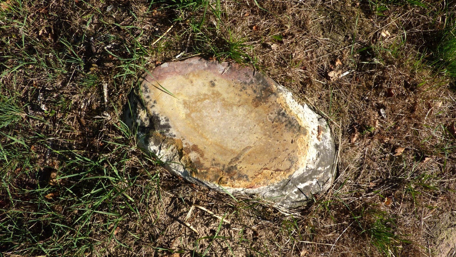
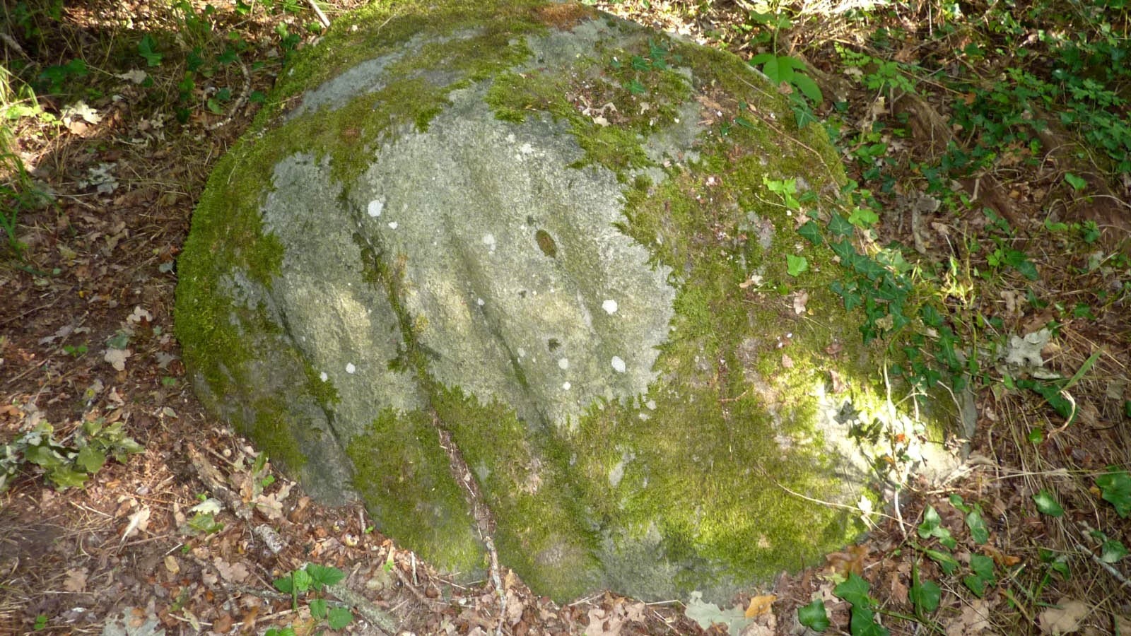
5 - POLISSOIR DU CHÂTEAU D'EAU : A 25 m du chemin au sud-est, dans le sous-bois. Le bloc se trouve juste au niveau de la rupture de pente.Les traces de polissage sont en face sud-est. Elles ne sont donc pas visibles lorsque l’on arrive au bloc. C’est le plus important de la commune: Il porte 10 sillons, 4 cuvettes,8 zones polies entre les sillons, ainsi que 4 traces discontinues de polissage
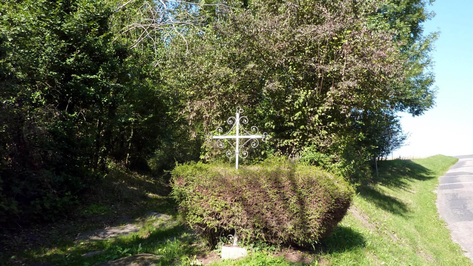
La croix : Croix en haut de la rue des roches
Le puits : Puits typiquement régional, à manivelle et couverts d'un auvent.
Au niveau du croisement des chemins, des balises nous invitent à visiter 3 sites de polissoirs. Site n°6 : La Vallée Ragonde (K) à droite 280 m (aller-retour) Site n°7 : Le Clos des Raves (l) à droite 640 m (aller-retour) Site n°8 : Les 48 Arpents (M) à droite 780 m (aller-retour) Poursuivre sur le chemin balisé en jaune sur 400 m, pour arrivée sur la rue Montivier
6 - LA VALLÉE RAGONDE : Bloc de 2,65 m par 1,25 m, haut de 1 m.Il est pris dans la pente. Il porte 2 cuvettes, une de 52 par 14 cm, profonde de 0,2 cm l’autre de 35 par 14 cm, profonde de 0,15 cm.
7 - LE CLOS DES RAVES : Bloc zoomorphe de 7 m de long par 1,5 m à 2 m de large.Il porte en son extrémité ouest 4 sillons et une cuvette.On trouve sur le gros bombé de la roche en partie Est une trace discontinue de polissage de 18,5 par 10 cm
8 - LES 48 ARPENTS : Bloc de 2,5 par 1,7 m, haut de 0,8 m.Il porte 1 sillon, 2 cuvettes 2 zones polies et 3 traces discontinues de polissage.
Plus de renseignements : https://www.fay-les-nemours.fr/les-polissoirs_fr.html
Sur mon blog : https://randowill77.blogspot.com/2015/09/randonnee-fay-les-nemours.html
 Photos
Commentaires
Pas encore de commentaire, connectez-vous pour en ajouter un.
Connectez-vous pour ajouter un commentaire
Longueur et nombre de points

11.74 km

218 pts

17 marqueurs
Denivelé et altitude
Calculés avec un seuil de 10 mètres et un lissage sur 3 points (corrigé car densité de points faible)

129 m

130 m

115 m

74 m

101 m
Plus

Affichée 1970 fois et téléchargée 75 fois depuis le 07.04.20 15:25
KME
13.5 kilomètres effort
Carte + Profil [Afficher un aperçu]
<iframe src="https://www.visugpx.com/kG9HpCpzPK?iframe" allowfullscreen style="border: 0;width: 100%; height: 540px;" loading="lazy" scrolling="no"></iframe>
Carte uniquement [Afficher un aperçu]
<iframe src="https://www.visugpx.com/kG9HpCpzPK?iframe&maponly" allowfullscreen style="border: 0;width: 100%; height: 540px;" loading="lazy" scrolling="no"></iframe>

 ForumsToposLes plus belles randosSegments
 Offre Premium
 Connexion


 Circuit des polissoirs Faÿ-les-Nemours

 35
35 53
53 13 [Légende]


