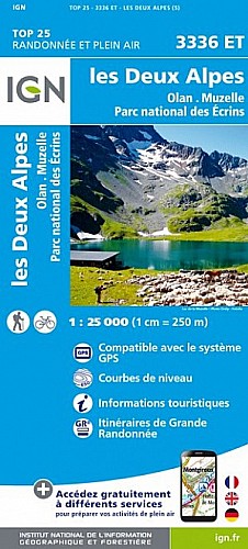
Jusqu'au col du Vallon sentier bien tracé. Du col parcours hors sentier, bien suivre les nombreux cairns (a faire que par très beau temps). Vers 2850m passage aérien sur quelques mètres ou il faut parfois mettre les mains. A la descente jusqu'au col bien suivre les cairns. Ensuite très longue descente.
 Actions
12 km

+939 m/-2098 m

05:00

Cliquez pour activer


Cliquez et déplacez la souris sur le profil pour analyser un tronçon (2 doigts sur mobile)
Commentaires
Pas encore de commentaire, connectez-vous pour en ajouter un.
Connectez-vous pour ajouter un commentaire
Longueur et nombre de points

11.8 km

1224 pts
Denivelé et altitude
Calculés avec un seuil de 10 mètres et un lissage sur 5 points

939 m

2098 m

3013 m

982 m

2066 m
Date et durée

29 septembre 2019
07:30

29 septembre 2019
14:30

07:00:35

05:07:17

01:53:18
Vitesses et denivelés horaires

2.3 km/h
Détail »

5 km/h
au km 5.4

453 m/h
2h02m14s

-722 m/h
2h52m09s
| km | Temps | Vitesse | Pause |
|---|
| 1 | 26'14" | 2.3 km/h | |
| 2 | 39'16" | 1.5 km/h | |
| 3 | 39'27" | 1.5 km/h | 16'43" |
| 4 | 36'32" | 1.6 km/h | 29'26" |
| 5 | 28'12" | 2.1 km/h | 11'32" |
| 6 | 15'22" | 3.9 km/h | 09'20" |
| 7 | 21'17" | 2.8 km/h | |
| 8 | 25'54" | 2.3 km/h | |
| 9 | 23'46" | 2.5 km/h | |
| 10 | 19'10" | 3.1 km/h | 44'51" |
| 11 | 20'01" | 3 km/h | |
Dépense calorique (estimation)

876 Cal
171 Cal/h
Plus

Affichée 351 fois et téléchargée 8 fois depuis le 07.04.20 15:25
Carte + Profil [Afficher un aperçu]
<iframe src="https://www.visugpx.com/kDZA8GqhY1?iframe" allowfullscreen style="border: 0;width: 100%; height: 540px;" scrolling="no"></iframe>
Carte uniquement [Afficher un aperçu]
<iframe src="https://www.visugpx.com/kDZA8GqhY1?iframe&maponly" allowfullscreen style="border: 0;width: 100%; height: 540px;" scrolling="no"></iframe>

Nous avons pris en compte votre choix.
Vous souhaitez maîtriser les informations qui peuvent être recueillies lors de votre navigation et avez refusé les cookies de personnalisation des annonces, c'est légitime.
Parce que le service fourni par VisuGPX a un coût, accepteriez-vous quand même que nous utilisions des cookies pour vous présenter des annonces non personnalisées ? Ces cookies ne sont pas des cookies de tracking mais de simples des cookies techniques de diffusion qui garantissent le respect votre vie privée.


 Actions
  12 km
12 km +939 m/-2098 m
 05:00
05:00

 Cliquez et déplacez la souris sur le profil pour analyser un tronçon (2 doigts sur mobile)
 160
160 447
447 98 [Légende]
 Pour soutenir VisuGPX, faites le bon choix