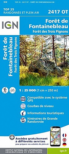
Promenade facile à faire dans le massif des Trois Pignons : il y a peu de dénivelée, mais le sable est présent partout : vous aurez de beaux mollets à la fin de la balade.
Si vous commencez le matin, pique-niquez et bronzez l'après-midi près du Bilboquet, rocher emblématique des sables du Cul de Chien.
Utilisez la carte et la trace, il y a beaucoup de sentiers non répertoriés.
 Actions
7 km

+174 m/-179 m

02:00

Cliquez pour activer


Cliquez et déplacez la souris sur le profil pour analyser un tronçon (2 doigts sur mobile)
Commentaires
Pas encore de commentaire, connectez-vous pour en ajouter un.
Connectez-vous pour ajouter un commentaire
Longueur et nombre de points

6.99 km

507 pts
Denivelé et altitude
Calculés avec un seuil de 10 mètres et un lissage sur 5 points

174 m

179 m

76 m

42 m

62 m
Date et durée

24 avril 2019
14:14

24 avril 2019
16:27

02:13:36

02:03:13

00:10:23
Vitesses et denivelés horaires

3.4 km/h
Détail »

4.7 km/h
au km 0.3

148 m/h
0h30m08s

-251 m/h
0h19m18s
| km | Temps | Vitesse | Pause |
|---|
| 1 | 16'22" | 3.7 km/h | |
| 2 | 17'20" | 3.5 km/h | 02'12" |
| 3 | 16'13" | 3.7 km/h | |
| 4 | 17'00" | 3.5 km/h | 03'12" |
| 5 | 17'10" | 3.5 km/h | |
| 6 | 19'20" | 3.1 km/h | 01'42" |
Dépense calorique (estimation)

197 Cal
96 Cal/h
Plus

Affichée 4762 fois et téléchargée 491 fois depuis le 07.04.20 15:25
Carte + Profil [Afficher un aperçu]
<iframe src="https://www.visugpx.com/ji9sxfM1uU?iframe" allowfullscreen style="border: 0;width: 100%; height: 540px;" scrolling="no"></iframe>
Carte uniquement [Afficher un aperçu]
<iframe src="https://www.visugpx.com/ji9sxfM1uU?iframe&maponly" allowfullscreen style="border: 0;width: 100%; height: 540px;" scrolling="no"></iframe>


Nous avons pris en compte votre choix.
Vous souhaitez maîtriser les informations qui peuvent être recueillies lors de votre navigation et avez refusé les cookies de personnalisation des annonces, c'est légitime.
Parce que le service fourni par VisuGPX a un coût, accepteriez-vous quand même que nous utilisions des cookies pour vous présenter des annonces non personnalisées ? Ces cookies ne sont pas des cookies de tracking mais de simples des cookies techniques de diffusion qui garantissent le respect votre vie privée.


 Actions
  7 km
7 km +174 m/-179 m
 02:00
02:00

 Cliquez et déplacez la souris sur le profil pour analyser un tronçon (2 doigts sur mobile)
 22
22 31
31 4 [Légende]

 Pour soutenir VisuGPX, faites le bon choix