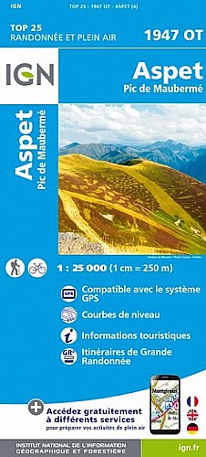
Départ du Col de Menté.
Mise en jambe sur le chemin forestier, jusqu'à la cabane d'Escarlette, puis montée assez raide (en contournant le Pic) jusqu'au col.
Passage par le Sommet des Parets puis une traversée en suivant la crête (passage où il faut mettre les mains) jusqu'au Col de l'âne.Montée au Pic de Pique-Poque par un sentier bien marqué.
Arrivé au sommet profiter pleinement d'un panorama sur une grande partie de la chaîne des Pyrénées.
 Actions
10 km

+771 m/-773 m

04:15

Cliquez pour activer


Cliquez et déplacez la souris sur le profil pour analyser un tronçon (2 doigts sur mobile)
Commentaires
Pas encore de commentaire, connectez-vous pour en ajouter un.
Connectez-vous pour ajouter un commentaire
Longueur et nombre de points

10.15 km

1826 pts
Denivelé et altitude
Calculés sans seuil et un lissage sur 3 points

771 m

774 m

1896 m

1288 m

1547 m
Date et durée

26 juin 2018
09:46

26 juin 2018
15:51

06:05:00

04:11:30

01:53:30
Vitesses et denivelés horaires

2.4 km/h
Détail »

4.9 km/h
au km 7.7

328 m/h
2h12m30s

-388 m/h
1h52m30s
| km | Temps | Vitesse | Pause |
|---|
| 1 | 18'40" | 3.2 km/h | 04'20" |
| 2 | 18'38" | 3.2 km/h | 01'20" |
| 3 | 27'38" | 2.2 km/h | 03'10" |
| 4 | 33'28" | 1.8 km/h | 28'40" |
| 5 | 40'09" | 1.5 km/h | 10'50" |
| 6 | 31'54" | 1.9 km/h | 46'10" |
| 7 | 29'51" | 2 km/h | 17'00" |
| 8 | 15'51" | 3.8 km/h | |
| 9 | 18'11" | 3.3 km/h | 02'00" |
| 10 | 14'52" | 4 km/h | |
Dépense calorique (estimation)

618 Cal
147 Cal/h
Plus

Affichée 794 fois et téléchargée 11 fois depuis le 07.04.20 15:25
Carte + Profil [Afficher un aperçu]
<iframe src="https://www.visugpx.com/jI9RFYjifL?iframe" allowfullscreen style="border: 0;width: 100%; height: 540px;" scrolling="no"></iframe>
Carte uniquement [Afficher un aperçu]
<iframe src="https://www.visugpx.com/jI9RFYjifL?iframe&maponly" allowfullscreen style="border: 0;width: 100%; height: 540px;" scrolling="no"></iframe>

Nous avons pris en compte votre choix.
Vous souhaitez maîtriser les informations qui peuvent être recueillies lors de votre navigation et avez refusé les cookies de personnalisation des annonces, c'est légitime.
Parce que le service fourni par VisuGPX a un coût, accepteriez-vous quand même que nous utilisions des cookies pour vous présenter des annonces non personnalisées ? Ces cookies ne sont pas des cookies de tracking mais de simples des cookies techniques de diffusion qui garantissent le respect votre vie privée.


 Actions
  10 km
10 km +771 m/-773 m
 04:15
04:15

 Cliquez et déplacez la souris sur le profil pour analyser un tronçon (2 doigts sur mobile)
 85
85 194
194 61 [Légende]
 Pour soutenir VisuGPX, faites le bon choix