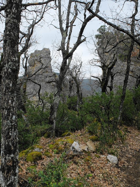
Au départ de Notre Dame de la Salvage (N44.09560 E3.18930) accès par un chemin de terre puis des sentiers, une boucle de 5.5 Kms avec de jolies vues , on descend vers la Dourbies, puis avant d'y arriver on remonte sur le Pompidou (un peu raide) puis retour sur ND de la Salvage ,2 ou 3 géocaches pour les mordus de ce jeu se trouvent sur le parcours
coord.info/GC51J36 
-
coord.info/GC51RRD 
-
coord.info/GC51J3P 
Bonne balade.

En cliquant en haut à droite vous pouvez changer la couche de visualisation.
 Actions
6 km

+228 m/-217 m

±02:00

Cliquez pour activer

Cliquez et déplacez la souris sur le profil pour analyser un tronçon (2 doigts sur mobile)
Commentaires
Pas encore de commentaire, connectez-vous pour en ajouter un.
Connectez-vous pour ajouter un commentaire
Longueur et nombre de points

5.51 km

156 pts
Denivelé et altitude
Calculés avec un seuil de 10 mètres et un lissage sur 5 points

228 m

217 m

751 m

554 m

666 m
Plus

Affichée 1052 fois et téléchargée 82 fois depuis le 31.01.17 11:56
Carte + Profil [Afficher un aperçu]
<iframe src="https://www.visugpx.com/ZObof1GCLz?iframe" allowfullscreen style="border: 0;width: 100%; height: 540px;" scrolling="no"></iframe>
Carte uniquement [Afficher un aperçu]
<iframe src="https://www.visugpx.com/ZObof1GCLz?iframe&maponly" allowfullscreen style="border: 0;width: 100%; height: 540px;" scrolling="no"></iframe>


Nous avons pris en compte votre choix.
Vous souhaitez maîtriser les informations qui peuvent être recueillies lors de votre navigation et avez refusé les cookies de personnalisation des annonces, c'est légitime.
Parce que le service fourni par VisuGPX a un coût, accepteriez-vous quand même que nous utilisions des cookies pour vous présenter des annonces non personnalisées ? Ces cookies ne sont pas des cookies de tracking mais de simples des cookies techniques de diffusion qui garantissent le respect votre vie privée.


 - coord.info/GC51RRD
  - coord.info/GC51J3P

 Actions
  6 km
6 km +228 m/-217 m
 ±02:00
 Cliquez et déplacez la souris sur le profil pour analyser un tronçon (2 doigts sur mobile)
 37
37 71
71 33 [Légende]

 Pour soutenir VisuGPX, faites le bon choix