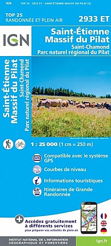
Ce parcours commence sur le parking de l auberge de Grange Rouet,à quelques KM du col de Pavezin (42), il est assez court ce qui permet aux Marcheurs d arriver en fin de boucle à l heure du repas et donc de savourer les produits locaux proposés par l aubergiste.
Bonne Marche et.....bon appétit ensuite.
 Actions
8 km

+392 m/-388 m

03:00

Cliquez pour activer


Cliquez et déplacez la souris sur le profil pour analyser un tronçon (2 doigts sur mobile)
Commentaires
Pas encore de commentaire, connectez-vous pour en ajouter un.
Connectez-vous pour ajouter un commentaire
Longueur et nombre de points

8.31 km

75 pts
Denivelé et altitude
Calculés avec un seuil de 10 mètres et sans lissage (corrigé car densité de points faible)

391 m

389 m

876 m

551 m

726 m
Date et durée

29 novembre 2015
09:03

29 novembre 2015
11:58

02:55:37
Vitesses et denivelés horaires

2.8 km/h
Détail »

4.5 km/h
au km 2.9

272 m/h
1h15m54s

-305 m/h
1h12m55s
| km | Temps | Vitesse | Pause |
|---|
| 1 | 24'35" | 2.4 km/h | |
| 2 | 22'05" | 2.7 km/h | |
| 3 | 15'41" | 3.8 km/h | |
| 4 | 20'03" | 3 km/h | |
| 5 | 21'59" | 2.7 km/h | |
| 6 | 14'02" | 4.3 km/h | |
| 7 | 23'35" | 2.5 km/h | |
| 8 | 17'32" | 3.4 km/h | |
Dépense calorique (estimation)

369 Cal
126 Cal/h
Plus

Affichée 694 fois et téléchargée 20 fois depuis le 27.11.15 20:53
Carte + Profil [Afficher un aperçu]
<iframe src="https://www.visugpx.com/VxW3v7BFVO?iframe" allowfullscreen style="border: 0;width: 100%; height: 540px;" scrolling="no"></iframe>
Carte uniquement [Afficher un aperçu]
<iframe src="https://www.visugpx.com/VxW3v7BFVO?iframe&maponly" allowfullscreen style="border: 0;width: 100%; height: 540px;" scrolling="no"></iframe>


Nous avons pris en compte votre choix.
Vous souhaitez maîtriser les informations qui peuvent être recueillies lors de votre navigation et avez refusé les cookies de personnalisation des annonces, c'est légitime.
Parce que le service fourni par VisuGPX a un coût, accepteriez-vous quand même que nous utilisions des cookies pour vous présenter des annonces non personnalisées ? Ces cookies ne sont pas des cookies de tracking mais de simples des cookies techniques de diffusion qui garantissent le respect votre vie privée.


 Actions
  8 km
8 km +392 m/-388 m
 03:00
03:00

 Cliquez et déplacez la souris sur le profil pour analyser un tronçon (2 doigts sur mobile)
 46
46 90
90 26 [Légende]

 Pour soutenir VisuGPX, faites le bon choix