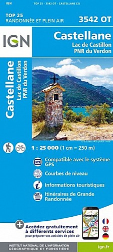
GR4, montée hors-sentier sportive pour rejoindre la crête. Possibilité d'aller jusqu'au sommet mais pour moi, ce jour là, le mistral était trop violent. Bergerie de la Guinchée, dont la porte est susceptible d'être bloquée par la neige. Descente dans une combe hors-sentier pour rejoindre le chemin de Soleilhas, où l'épicerie-café loue des raquettes pour ceux qui n'en n'ont pas.
 Actions
12 km

+736 m/-734 m

00:30

Cliquez pour activer


Cliquez et déplacez la souris sur le profil pour analyser un tronçon (2 doigts sur mobile)
Commentaires
Pas encore de commentaire, connectez-vous pour en ajouter un.
Connectez-vous pour ajouter un commentaire
Longueur et nombre de points

12.24 km

2115 pts
Denivelé et altitude
Calculés avec un seuil de 30 mètres et un lissage sur 13 points (corrigé car densité de points faible)

736 m

734 m

1794 m

1129 m

1365 m
Date et durée

28 janvier 2021
17:22

28 janvier 2021
18:00

00:37:23
Vitesses et denivelés horaires

19.6 km/h
Détail »

56.7 km/h
au km 8.4

2206 m/h
0h20m01s

-4502 m/h
0h09m27s
| km | Temps | Vitesse | Pause |
|---|
| 1 | 03'58" | 15.1 km/h | |
| 2 | 05'11" | 11.6 km/h | |
| 3 | 01'56" | 30.9 km/h | |
| 4 | 02'02" | 29.5 km/h | |
| 5 | 02'43" | 22.1 km/h | |
| 6 | 05'02" | 11.9 km/h | |
| 7 | 05'28" | 11 km/h | |
| 8 | 01'53" | 31.8 km/h | |
| 9 | 01'37" | 37.1 km/h | |
| 10 | 01'48" | 33.3 km/h | |
| 11 | 02'19" | 25.9 km/h | |
| 12 | 02'55" | 20.5 km/h | |
Dépense calorique (estimation)

699 Cal
1121 Cal/h
Plus

Affichée 126 fois et téléchargée 4 fois depuis le 12.02.21 17:33
Carte + Profil [Afficher un aperçu]
<iframe src="https://www.visugpx.com/StB2tHNgWm?iframe" allowfullscreen style="border: 0;width: 100%; height: 540px;" scrolling="no"></iframe>
Carte uniquement [Afficher un aperçu]
<iframe src="https://www.visugpx.com/StB2tHNgWm?iframe&maponly" allowfullscreen style="border: 0;width: 100%; height: 540px;" scrolling="no"></iframe>


Nous avons pris en compte votre choix.
Vous souhaitez maîtriser les informations qui peuvent être recueillies lors de votre navigation et avez refusé les cookies de personnalisation des annonces, c'est légitime.
Parce que le service fourni par VisuGPX a un coût, accepteriez-vous quand même que nous utilisions des cookies pour vous présenter des annonces non personnalisées ? Ces cookies ne sont pas des cookies de tracking mais de simples des cookies techniques de diffusion qui garantissent le respect votre vie privée.


 Actions
  12 km
12 km +736 m/-734 m
 00:30
00:30

 Cliquez et déplacez la souris sur le profil pour analyser un tronçon (2 doigts sur mobile)
 86
86 193
193 106 [Légende]

 Pour soutenir VisuGPX, faites le bon choix