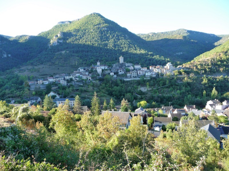
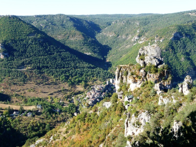
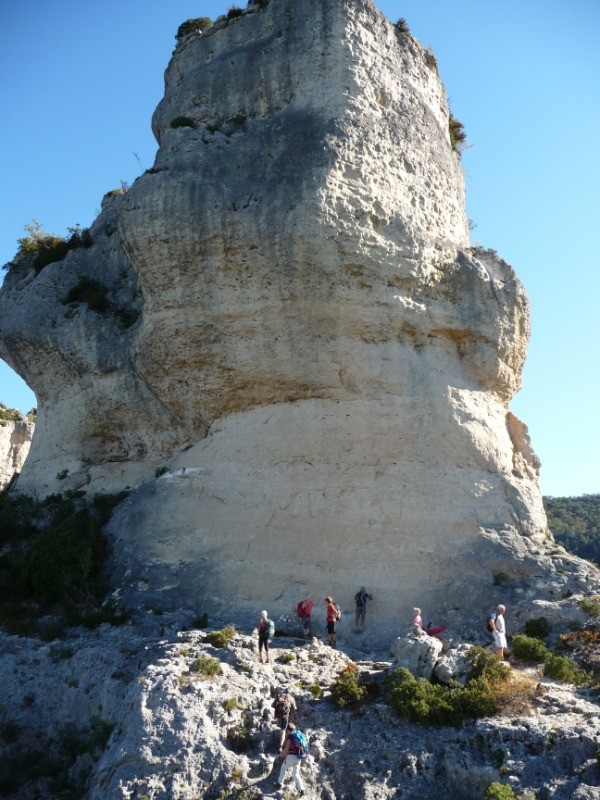
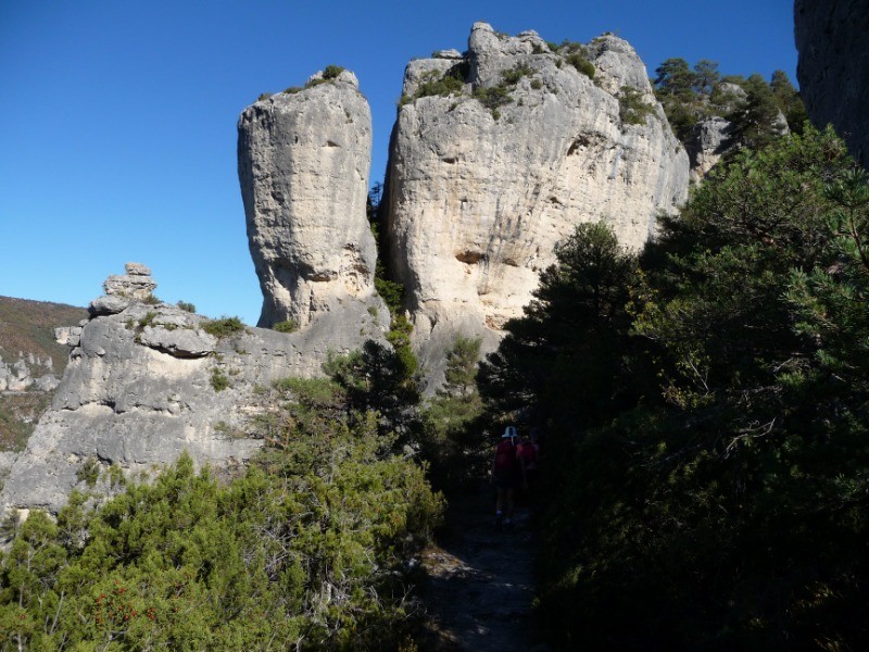
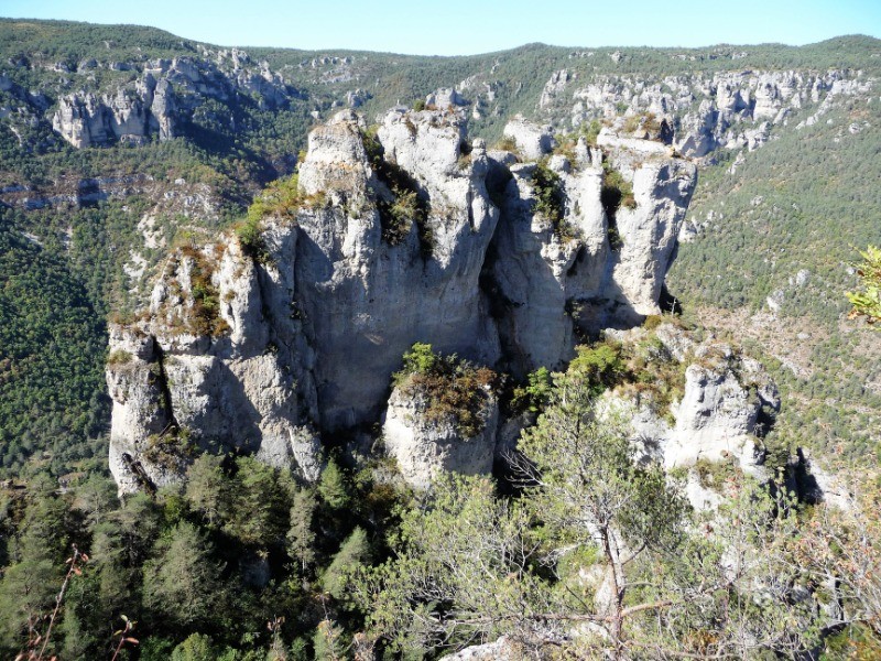
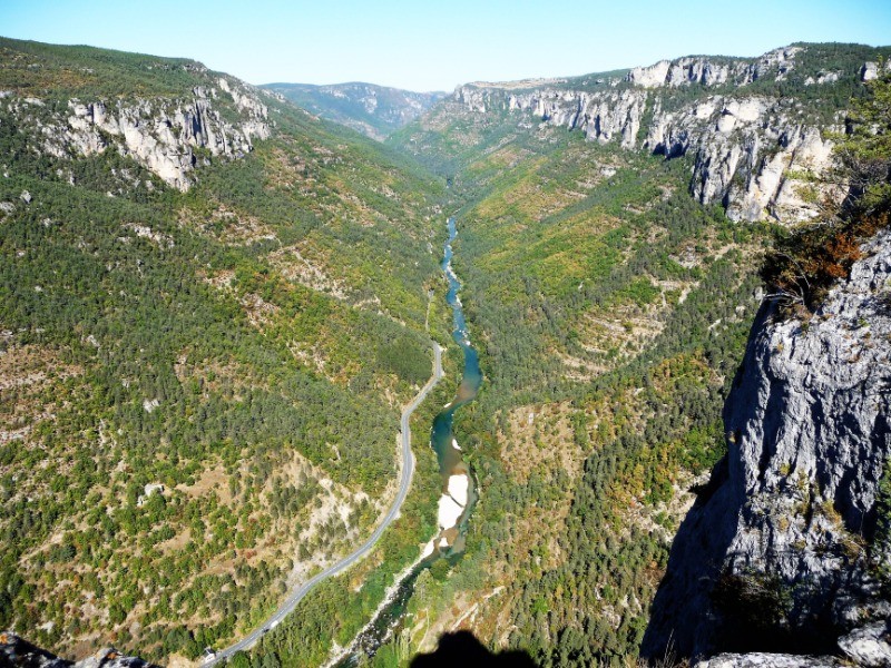
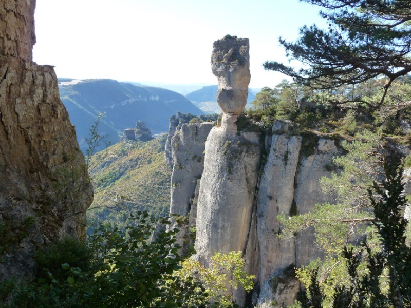
Une rando magnifique mais difficile, dans un site extraordinaire, réservée aux TRÈS bons marcheurs, avec quelques passages acrobatiques et des superbes vues sur les gorges du Tarn et de la Jonte, avec les vautours au dessus de votre tête.
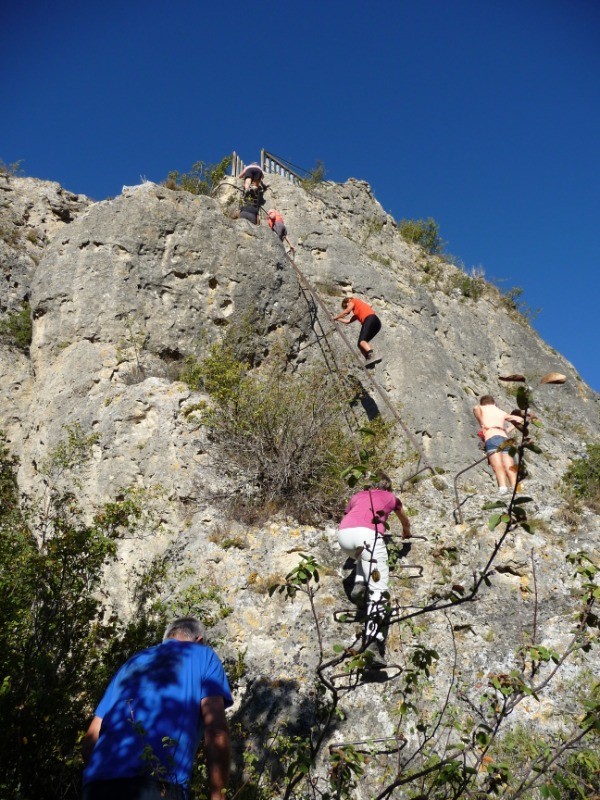
Possibilité de grimper par des échelles au rocher du Capluc et à Cinglegros pour les personnes expérimentées et non sujettes au vertige.
 Actions
16.7 km

+932 m
/-810 m
06:07

Cliquez pour activer


Cliquez et déplacez la souris sur le profil pour analyser un tronçon (2 doigts sur mobile)
 Photos
Commentaires
Pas encore de commentaire, connectez-vous pour en ajouter un.
Connectez-vous pour ajouter un commentaire
Longueur et nombre de points

16.75 km

2192 pts
Denivelé et altitude
Calculés avec un seuil de 10 mètres et un lissage sur 5 points

932 m

811 m

897 m

289 m

737 m
Date et durée

04 octobre 2018
09:14

04 octobre 2018
17:28

08:13:53

06:07:42

02:06:11
Vitesses et denivelés horaires

2.7 km/h
Détail »

5.3 km/h
au km 11.1

304 m/h
2h44m46s

-299 m/h
2h17m07s
| km | Temps | Vitesse | Pause |
|---|
| 1 | 24'52" | 2.4 km/h | 06'18" |
| 2 | 36'20" | 1.7 km/h | 39'13" |
| 3 | 29'35" | 2 km/h | 07'58" |
| 4 | 16'25" | 3.7 km/h | |
| 5 | 20'05" | 3 km/h | 01'40" |
| 6 | 18'08" | 3.3 km/h | |
| 7 | 30'28" | 2 km/h | 53'33" |
| 8 | 30'00" | 2 km/h | 04'13" |
| 9 | 15'02" | 4 km/h | 02'50" |
| 10 | 13'37" | 4.4 km/h | |
| 11 | 14'10" | 4.2 km/h | |
| 12 | 17'04" | 3.5 km/h | |
| 13 | 21'57" | 2.7 km/h | 03'20" |
| 14 | 26'21" | 2.3 km/h | 02'00" |
| 15 | 24'53" | 2.4 km/h | 01'45" |
| 16 | 15'18" | 3.9 km/h | |
Dépense calorique (estimation)

790 Cal
129 Cal/h
Plus

Affichée 8272 fois et téléchargée 526 fois depuis le 07.04.20 15:25
KME
28.8 kilomètres effort
Carte + Profil [Afficher un aperçu]
<iframe src="https://www.visugpx.com/SqNKpVJTBZ?iframe" allowfullscreen style="border: 0;width: 100%; height: 540px;" loading="lazy" scrolling="no"></iframe>
Carte uniquement [Afficher un aperçu]
<iframe src="https://www.visugpx.com/SqNKpVJTBZ?iframe&maponly" allowfullscreen style="border: 0;width: 100%; height: 540px;" loading="lazy" scrolling="no"></iframe>


 ForumsToposLes plus belles randosSegments
 Offre Premium
 Connexion


 93
93 200
200 118 [Légende]


