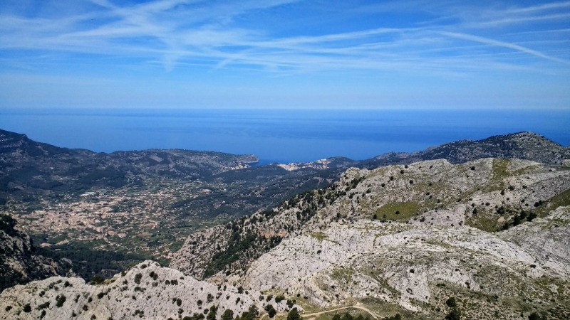
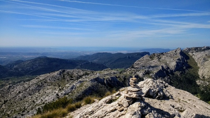
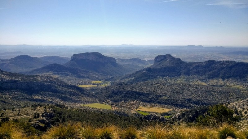
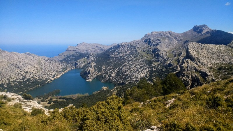
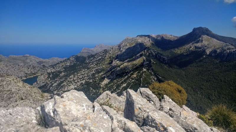
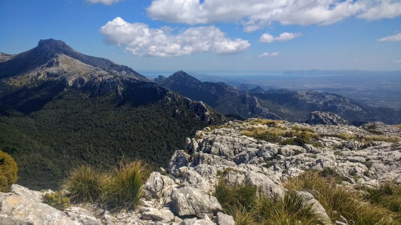
Itinéraire original pour relier Lluc depuis Soller en passant par deux sommets offrant une vue somptueuse sur l'île.
 Actions
27.5 km

+1997 m
/-1602 m
05:27

Cliquez pour activer


Cliquez et déplacez la souris sur le profil pour analyser un tronçon (2 doigts sur mobile)
 Photos
Commentaires
Pas encore de commentaire, connectez-vous pour en ajouter un.
Connectez-vous pour ajouter un commentaire
Longueur et nombre de points

27.47 km

2405 pts
Denivelé et altitude
Calculés avec un seuil de 10 mètres et un lissage sur 5 points

1996 m

1603 m

1200 m

110 m

815 m
Date et durée

17 avril 2018
09:57

17 avril 2018
15:53

05:55:44

05:27:52

00:27:52
Vitesses et denivelés horaires

5 km/h
Détail »

14.6 km/h
au km 3.6

663 m/h
2h54m08s

-781 m/h
1h56m50s
| km | Temps | Vitesse | Pause |
|---|
| 1 | 09'10" | 6.5 km/h | |
| 2 | 11'31" | 5.2 km/h | |
| 3 | 11'56" | 5 km/h | |
| 4 | 10'51" | 5.5 km/h | |
| 5 | 12'12" | 4.9 km/h | |
| 6 | 17'16" | 3.5 km/h | |
| 7 | 15'14" | 3.9 km/h | 15'27" |
| 8 | 07'06" | 8.4 km/h | |
| 9 | 05'31" | 10.9 km/h | |
| 10 | 05'55" | 10.1 km/h | |
| 11 | 08'05" | 7.4 km/h | |
| 12 | 11'37" | 5.2 km/h | |
| 13 | 22'00" | 2.7 km/h | |
| 14 | 23'48" | 2.5 km/h | 01'25" |
| 15 | 16'27" | 3.6 km/h | |
| 16 | 13'38" | 4.4 km/h | 11'00" |
| 17 | 08'54" | 6.7 km/h | |
| 18 | 11'56" | 5 km/h | |
| 19 | 13'57" | 4.3 km/h | |
| 20 | 14'03" | 4.3 km/h | |
| 21 | 16'13" | 3.7 km/h | |
| 22 | 10'21" | 5.8 km/h | |
| 23 | 13'24" | 4.5 km/h | |
| 24 | 09'38" | 6.2 km/h | |
| 25 | 07'02" | 8.5 km/h | |
| 26 | 08'27" | 7.1 km/h | |
| 27 | 07'33" | 7.9 km/h | |
Dépense calorique (estimation)

1814 Cal
332 Cal/h
Plus

Affichée 1622 fois et téléchargée 45 fois depuis le 07.04.20 15:25
KME
52.8 kilomètres effort
Carte + Profil [Afficher un aperçu]
<iframe src="https://www.visugpx.com/RUG03BGw1X?iframe" allowfullscreen style="border: 0;width: 100%; height: 540px;" loading="lazy" scrolling="no"></iframe>
Carte uniquement [Afficher un aperçu]
<iframe src="https://www.visugpx.com/RUG03BGw1X?iframe&maponly" allowfullscreen style="border: 0;width: 100%; height: 540px;" loading="lazy" scrolling="no"></iframe>
 ForumsToposLes plus belles randosSegments
 Offre Premium
 Connexion


 167
167 389
389 234 [Légende]


