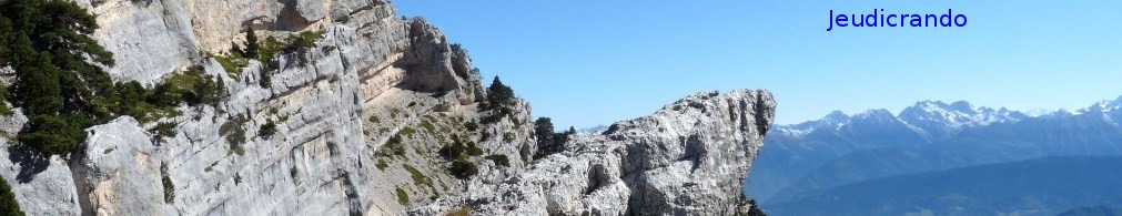
Ciel couvert ce matin pour les 11 randonneurs au départ "des Rochettes" en direction de la Pierre Percée 7eme merveille du Dauphiné. le chemin s'élève en pente raide sitôt la route traversée puis la montée se fait tranquillement par un chemin bordé de Hêtres, nous découvrons les lacs de Laffrey sur la gauche du chemin ou les arbres on subit une coupe sévère. Nous arrivons déjà en haut de la côte à l'abri du vent, le ciel est de plus en plus menaçant au sud. Nous descendons vers la Pierre Persée.....
 Actions
16.2 km

+716 m
/-719 m
04:47

Cliquez pour activer


Cliquez et déplacez la souris sur le profil pour analyser un tronçon (2 doigts sur mobile)
Commentaires
Pas encore de commentaire, connectez-vous pour en ajouter un.
Connectez-vous pour ajouter un commentaire
Longueur et nombre de points

16.15 km

1572 pts
Denivelé et altitude
Calculés sans seuil et un lissage sur 5 points

716 m

719 m

1274 m

962 m

1130 m
Date et durée

12 avril 2018
09:40

12 avril 2018
16:15

06:35:09

04:47:35

01:47:34
Vitesses et denivelés horaires

3.4 km/h
Détail »

4.7 km/h
au km 9.8

309 m/h
1h57m03s

-343 m/h
1h46m54s
| km | Temps | Vitesse | Pause |
|---|
| 1 | 22'55" | 2.6 km/h | 04'49" |
| 2 | 17'19" | 3.5 km/h | |
| 3 | 15'42" | 3.8 km/h | |
| 4 | 17'52" | 3.4 km/h | 08'26" |
| 5 | 15'54" | 3.8 km/h | 02'07" |
| 6 | 15'41" | 3.8 km/h | 10'45" |
| 7 | 19'07" | 3.1 km/h | 02'49" |
| 8 | 19'00" | 3.2 km/h | 56'09" |
| 9 | 15'12" | 3.9 km/h | |
| 10 | 15'11" | 4 km/h | 09'39" |
| 11 | 21'22" | 2.8 km/h | 03'08" |
| 12 | 23'27" | 2.6 km/h | 06'10" |
| 13 | 15'42" | 3.8 km/h | |
| 14 | 18'10" | 3.3 km/h | |
| 15 | 16'14" | 3.7 km/h | 02'32" |
| 16 | 16'22" | 3.7 km/h | |
Dépense calorique (estimation)

544 Cal
113 Cal/h
Plus

Affichée 791 fois et téléchargée 44 fois depuis le 07.04.20 15:25
KME
25.7 kilomètres effort
Carte + Profil [Afficher un aperçu]
<iframe src="https://www.visugpx.com/NwBOD4bRec?iframe" allowfullscreen style="border: 0;width: 100%; height: 540px;" loading="lazy" scrolling="no"></iframe>
Carte uniquement [Afficher un aperçu]
<iframe src="https://www.visugpx.com/NwBOD4bRec?iframe&maponly" allowfullscreen style="border: 0;width: 100%; height: 540px;" loading="lazy" scrolling="no"></iframe>

 ForumsToposLes plus belles randosSegments
 Offre Premium
 Connexion


 74
74 151
151 85 [Légende]


