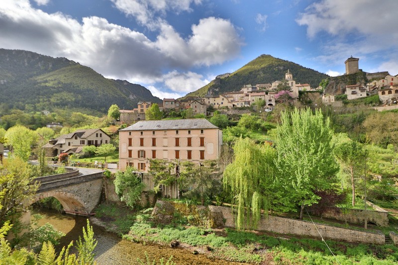
Au départ de
Peyreleau séparé de
Le Rozier par
La Jonte (R2).
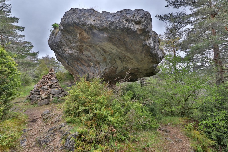
Repérer le Pylone au pt ign 843, c'est la direction à suivre (peinture jaune sur le parcours). Suivre ensuite les indications
Champignon préhistorique .
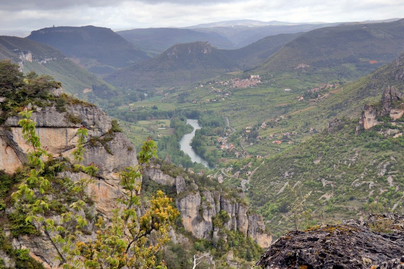
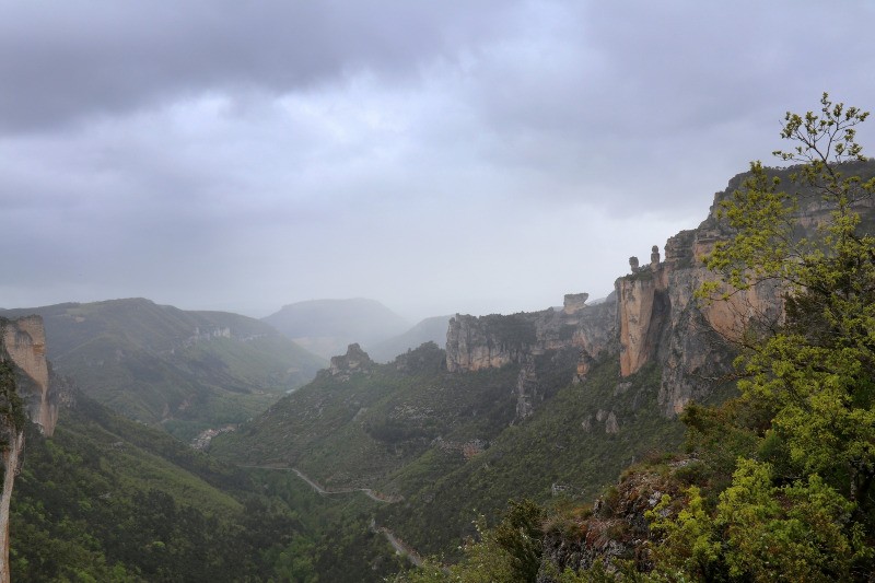
Suivre le sentier en Balcon qui domine
La Jonte et offre un panorama superbe sur le
Vase de Chine et
Vase de Sèvres. Le sentier aérien par endroit amène à
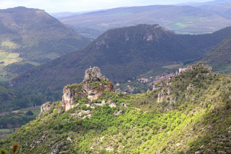
L'Ermitage Saint Michel.
Monter à son sommet est facultatif (R4) mais donne une idée du travail d'orfèvre des anciens!
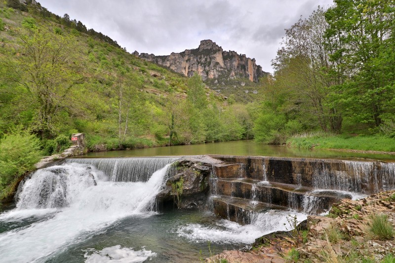
De
l'Ermitage St Michel , rejoindre
La Jonte en contrebas puis la longer jusqu'à
Peyreleau
Photos ici:
photos.app.goo.gl/XmNGzqSZ6DBgZuH87 Actions
11 km

+556 m
/-565 m
04:08

Cliquez pour activer


Cliquez et déplacez la souris sur le profil pour analyser un tronçon (2 doigts sur mobile)
 Photos
Commentaires
Pas encore de commentaire, connectez-vous pour en ajouter un.
Connectez-vous pour ajouter un commentaire
Longueur et nombre de points

10.97 km

479 pts

3 marqueurs
Denivelé et altitude
Calculés avec un seuil de 10 mètres et un lissage sur 5 points

556 m

566 m

845 m

402 m

614 m
Date et durée

09 mai 2019
10:07

09 mai 2019
15:48

05:40:49

04:08:58

01:31:51
Vitesses et denivelés horaires

2.6 km/h
Détail »

6.6 km/h
au km 8.6

332 m/h
1h29m50s

-367 m/h
1h21m32s
| km | Temps | Vitesse | Pause |
|---|
| 1 | 19'44" | 3 km/h | |
| 2 | 32'21" | 1.9 km/h | 05'26" |
| 3 | 30'57" | 1.9 km/h | 15'24" |
| 4 | 30'04" | 2 km/h | 17'46" |
| 5 | 21'48" | 2.8 km/h | 09'52" |
| 6 | 19'48" | 3 km/h | |
| 7 | 22'00" | 2.7 km/h | 20'57" |
| 8 | 22'05" | 2.7 km/h | 14'46" |
| 9 | 14'33" | 4.1 km/h | 07'40" |
| 10 | 18'49" | 3.2 km/h | |
Dépense calorique (estimation)

502 Cal
121 Cal/h
Plus

Affichée 2629 fois et téléchargée 196 fois depuis le 07.04.20 15:25
KME
18.4 kilomètres effort
Carte + Profil [Afficher un aperçu]
<iframe src="https://www.visugpx.com/JHkgoLCi1y?iframe" allowfullscreen style="border: 0;width: 100%; height: 540px;" loading="lazy" scrolling="no"></iframe>
Carte uniquement [Afficher un aperçu]
<iframe src="https://www.visugpx.com/JHkgoLCi1y?iframe&maponly" allowfullscreen style="border: 0;width: 100%; height: 540px;" loading="lazy" scrolling="no"></iframe>


 ForumsToposLes plus belles randosSegments
 Offre Premium
 Connexion


 59
59 121
121 62 [Légende]


