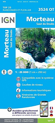
Randonnée effectuée le 2 aout 2017.
L'indice IBP d'effort est de 64, (suivant l'échelle de la FFRP) un score compris entre 51 et 75 correspond au niveau 3 qualifié de "PEU DIFFICILE". La randonnée pédestre nécessite un certain engagement physique qui reste toutefois mesuré. Ce niveau correspond à des randonnées pédestres modérées.
 Actions
17 km

+529 m/-528 m

05:00

Cliquez pour activer


Cliquez et déplacez la souris sur le profil pour analyser un tronçon (2 doigts sur mobile)
Commentaires
Pas encore de commentaire, connectez-vous pour en ajouter un.
Connectez-vous pour ajouter un commentaire
Longueur et nombre de points

16.87 km

1414 pts
Denivelé et altitude
Calculés avec un seuil de 10 mètres et un lissage sur 5 points

528 m

529 m

1303 m

1035 m

1130 m
Date et durée

02 août 2017
09:54

02 août 2017
16:36

06:41:38

04:55:32

01:46:06
Vitesses et denivelés horaires

3.4 km/h
Détail »

5.2 km/h
au km 10.8

294 m/h
1h35m49s

-325 m/h
1h26m43s
| km | Temps | Vitesse | Pause |
|---|
| 1 | 14'07" | 4.2 km/h | 12'48" |
| 2 | 19'56" | 3 km/h | 04'51" |
| 3 | 18'09" | 3.3 km/h | |
| 4 | 15'35" | 3.8 km/h | |
| 5 | 22'31" | 2.7 km/h | 60'02" |
| 6 | 18'32" | 3.2 km/h | |
| 7 | 19'34" | 3.1 km/h | 03'29" |
| 8 | 22'11" | 2.7 km/h | 03'22" |
| 9 | 16'40" | 3.6 km/h | |
| 10 | 15'23" | 3.9 km/h | 03'50" |
| 11 | 15'11" | 4 km/h | |
| 12 | 13'01" | 4.6 km/h | |
| 13 | 15'48" | 3.8 km/h | 13'36" |
| 14 | 18'21" | 3.3 km/h | |
| 15 | 18'38" | 3.2 km/h | |
| 16 | 18'42" | 3.2 km/h | 01'36" |
Dépense calorique (estimation)

550 Cal
112 Cal/h
Plus

Affichée 1803 fois et téléchargée 129 fois depuis le 07.04.20 15:25
Carte + Profil [Afficher un aperçu]
<iframe src="https://www.visugpx.com/GgUnSxzTJX?iframe" allowfullscreen style="border: 0;width: 100%; height: 540px;" scrolling="no"></iframe>
Carte uniquement [Afficher un aperçu]
<iframe src="https://www.visugpx.com/GgUnSxzTJX?iframe&maponly" allowfullscreen style="border: 0;width: 100%; height: 540px;" scrolling="no"></iframe>

Nous avons pris en compte votre choix.
Vous souhaitez maîtriser les informations qui peuvent être recueillies lors de votre navigation et avez refusé les cookies de personnalisation des annonces, c'est légitime.
Parce que le service fourni par VisuGPX a un coût, accepteriez-vous quand même que nous utilisions des cookies pour vous présenter des annonces non personnalisées ? Ces cookies ne sont pas des cookies de tracking mais de simples des cookies techniques de diffusion qui garantissent le respect votre vie privée.


 Actions
  17 km
17 km +529 m/-528 m
 05:00
05:00

 Cliquez et déplacez la souris sur le profil pour analyser un tronçon (2 doigts sur mobile)
 64
64 117
117 45 [Légende]
 Pour soutenir VisuGPX, faites le bon choix