Sortie effectuée avec le Rando Club Yerrois
Tracée et menée par Marianne
 Actions
21.6 km

+30 m
/-35 m
05:07

Cliquez pour activer


Cliquez et déplacez la souris sur le profil pour analyser un tronçon (2 doigts sur mobile)
Détails
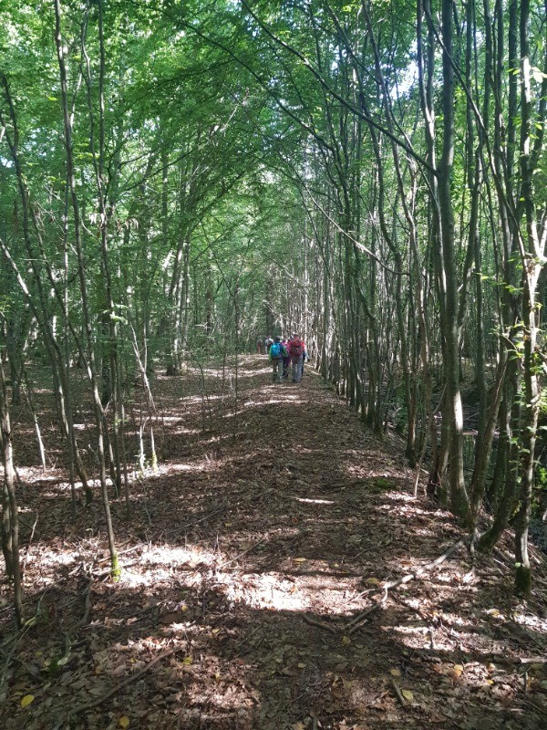
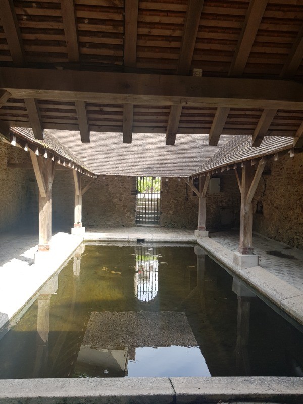
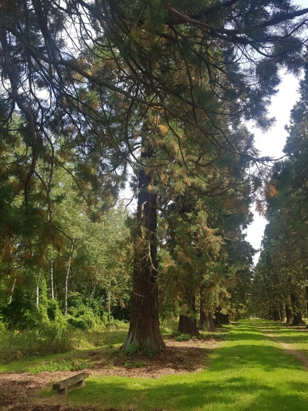
De nombreux passages sous bois idéal en forte chaleur
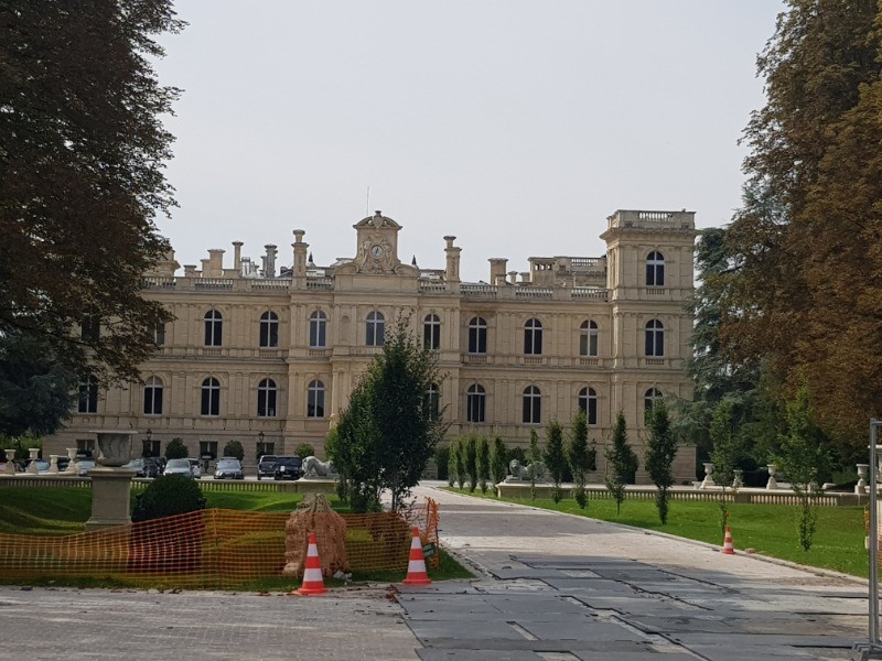
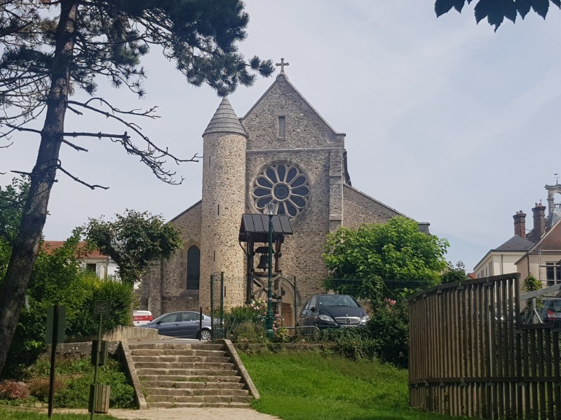
Passage près du château de Ferrières
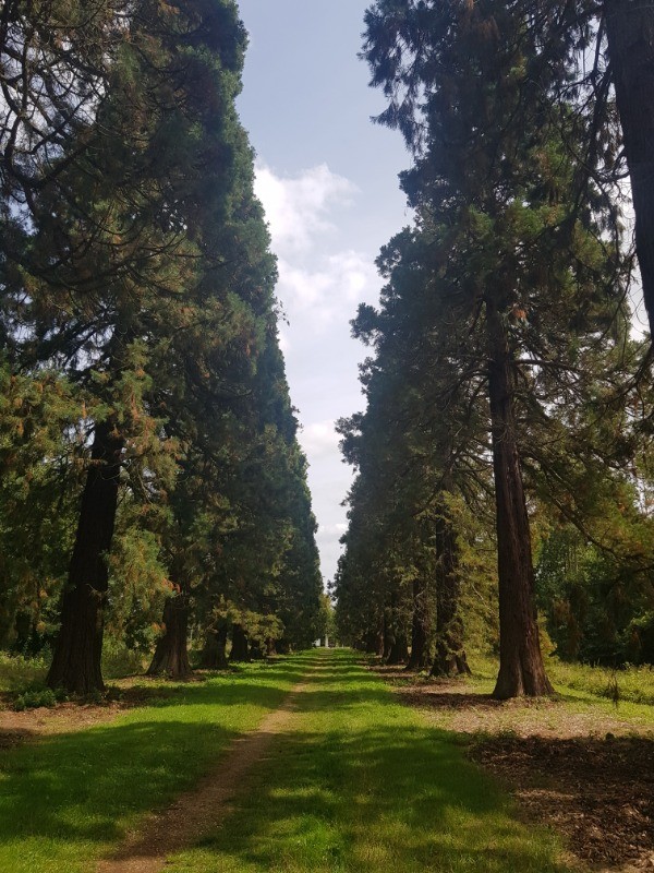
Une remarquable allée de séquoïas à signaler sur ce parcours
Aucune difficulté particulière à signaler
 Photos
Commentaires
Pas encore de commentaire, connectez-vous pour en ajouter un.
Connectez-vous pour ajouter un commentaire
Longueur et nombre de points

21.56 km

4402 pts
Denivelé et altitude
Calculés avec un seuil de 10 mètres et un lissage sur 5 points

30 m

36 m

174 m

153 m

166 m
Date et durée

21 août 2019
10:05

21 août 2019
16:30

06:24:25

05:07:16

01:17:09
Vitesses

4.2 km/h
Détail »

5.6 km/h
au km 20.2

-141 m/h
0h03m35s
| km | Temps | Vitesse | Pause |
|---|
| 1 | 14'08" | 4.2 km/h | 04'02" |
| 2 | 14'53" | 4 km/h | |
| 3 | 13'31" | 4.4 km/h | |
| 4 | 12'51" | 4.7 km/h | |
| 5 | 12'46" | 4.7 km/h | 14'58" |
| 6 | 13'35" | 4.4 km/h | |
| 7 | 13'58" | 4.3 km/h | |
| 8 | 12'45" | 4.7 km/h | 01'17" |
| 9 | 15'04" | 4 km/h | 03'39" |
| 10 | 16'16" | 3.7 km/h | |
| 11 | 16'07" | 3.7 km/h | 45'15" |
| 12 | 15'00" | 4 km/h | 03'28" |
| 13 | 16'54" | 3.6 km/h | |
| 14 | 13'30" | 4.4 km/h | |
| 15 | 15'20" | 3.9 km/h | |
| 16 | 12'54" | 4.6 km/h | |
| 17 | 13'25" | 4.5 km/h | |
| 18 | 17'18" | 3.5 km/h | 04'30" |
| 19 | 13'23" | 4.5 km/h | |
| 20 | 13'41" | 4.4 km/h | |
| 21 | 11'39" | 5.2 km/h | |
Dépense calorique (estimation)

276 Cal
54 Cal/h
Plus

Affichée 834 fois et téléchargée 44 fois depuis le 25.08.19 20:37
Carte + Profil [Afficher un aperçu]
<iframe src="https://www.visugpx.com/FckSEW2zIQ?iframe" allowfullscreen style="border: 0;width: 100%; height: 540px;" loading="lazy" scrolling="no"></iframe>
Carte uniquement [Afficher un aperçu]
<iframe src="https://www.visugpx.com/FckSEW2zIQ?iframe&maponly" allowfullscreen style="border: 0;width: 100%; height: 540px;" loading="lazy" scrolling="no"></iframe>

 ForumsToposLes plus belles randosSegments
 Offre Premium
 Connexion


 51
51 64
64 8 [Légende]


