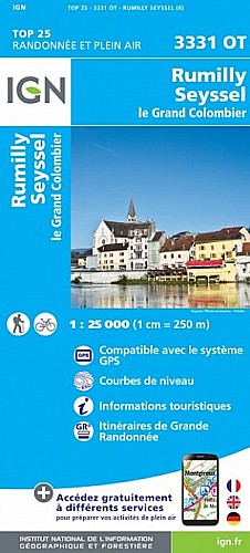
La vidéo est là : https://youtu.be/ffpw5bvatn8
 Actions
9 km

+453 m/-454 m

02:15

Cliquez pour activer


Cliquez et déplacez la souris sur le profil pour analyser un tronçon (2 doigts sur mobile)
Détails
Rando en boucle.
Départ : Moye (le Villard) 575m
Montée dans les bois par le chemin de la Voûte. On arrive sur la route du col du Clergeon qu'on suit sur 800m pour arriver au col du Clergeon. On passe au hameau inhabité de Montclergeon puis la croix nouvellement installée au point culminant 1025m.
Descente par le sentier du Gallet pour rallonger un peu la balade.
 Photos
Commentaires
Pas encore de commentaire, connectez-vous pour en ajouter un.
Connectez-vous pour ajouter un commentaire
Longueur et nombre de points

9.41 km

6066 pts
Denivelé et altitude
Calculés avec un seuil de 10 mètres et un lissage sur 5 points

453 m

455 m

1019 m

576 m

814 m
Date et durée

19 décembre 2019
12:13

19 décembre 2019
15:30

03:16:55

02:15:12

01:01:43
Vitesses et denivelés horaires

4.2 km/h
Détail »

7.1 km/h
au km 7.9

444 m/h
0h58m58s

-443 m/h
0h58m26s
| km | Temps | Vitesse | Pause |
|---|
| 1 | 16'06" | 3.7 km/h | |
| 2 | 20'33" | 2.9 km/h | |
| 3 | 18'17" | 3.3 km/h | 06'11" |
| 4 | 13'57" | 4.3 km/h | 14'46" |
| 5 | 12'40" | 4.7 km/h | 40'46" |
| 6 | 12'43" | 4.7 km/h | |
| 7 | 12'24" | 4.8 km/h | |
| 8 | 11'10" | 5.4 km/h | |
| 9 | 11'59" | 5 km/h | |
Dépense calorique (estimation)

565 Cal
251 Cal/h
Plus

Affichée 638 fois et téléchargée 37 fois depuis le 07.04.20 15:25
Carte + Profil [Afficher un aperçu]
<iframe src="https://www.visugpx.com/FWElCGJZBt?iframe" allowfullscreen style="border: 0;width: 100%; height: 540px;" scrolling="no"></iframe>
Carte uniquement [Afficher un aperçu]
<iframe src="https://www.visugpx.com/FWElCGJZBt?iframe&maponly" allowfullscreen style="border: 0;width: 100%; height: 540px;" scrolling="no"></iframe>

Nous avons pris en compte votre choix.
Vous souhaitez maîtriser les informations qui peuvent être recueillies lors de votre navigation et avez refusé les cookies de personnalisation des annonces, c'est légitime.
Parce que le service fourni par VisuGPX a un coût, accepteriez-vous quand même que nous utilisions des cookies pour vous présenter des annonces non personnalisées ? Ces cookies ne sont pas des cookies de tracking mais de simples des cookies techniques de diffusion qui garantissent le respect votre vie privée.


 Actions
  9 km
9 km +453 m/-454 m
 02:15
02:15

 Cliquez et déplacez la souris sur le profil pour analyser un tronçon (2 doigts sur mobile)


 50
50 100
100 37 [Légende]
 Pour soutenir VisuGPX, faites le bon choix