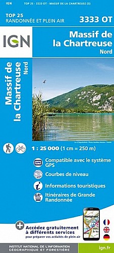
Le Sommet du Pinet (ou « Le Truc »?) peut être une randonnée alternative si vous avez trop fait le Granier. Même si elle n?offre pas le même superbe balcon sur Chambéry, la vue est assez similaire (Chartreuse, Belledonne, Combe de Savoie et Mont Blanc) avec un point de vue sur le Granier. Certains passages sont un peu raides mais rien n?est difficile.
 Actions
11 km

+846 m/-863 m

03:45

Cliquez pour activer


Cliquez et déplacez la souris sur le profil pour analyser un tronçon (2 doigts sur mobile)
Commentaires
Pas encore de commentaire, connectez-vous pour en ajouter un.
Connectez-vous pour ajouter un commentaire
Longueur et nombre de points

10.58 km

1115 pts
Denivelé et altitude
Calculés avec un seuil de 10 mètres et un lissage sur 5 points

845 m

863 m

1864 m

1077 m

1482 m
Date et durée

21 juillet 2020
13:53

21 juillet 2020
18:34

04:40:41

03:49:37

00:51:04
Vitesses et denivelés horaires

2.8 km/h
Détail »

6.4 km/h
au km 9.2

419 m/h
1h58m24s

-538 m/h
1h33m34s
| km | Temps | Vitesse | Pause |
|---|
| 1 | 22'59" | 2.6 km/h | |
| 2 | 32'11" | 1.9 km/h | |
| 3 | 18'41" | 3.2 km/h | |
| 4 | 30'44" | 2 km/h | |
| 5 | 25'23" | 2.4 km/h | 48'44" |
| 6 | 20'07" | 3 km/h | |
| 7 | 22'38" | 2.7 km/h | |
| 8 | 19'19" | 3.1 km/h | 02'20" |
| 9 | 20'23" | 2.9 km/h | |
| 10 | 10'33" | 5.7 km/h | |
Dépense calorique (estimation)

729 Cal
191 Cal/h
Plus

Affichée 563 fois et téléchargée 39 fois depuis le 23.07.20 07:42
Carte + Profil [Afficher un aperçu]
<iframe src="https://www.visugpx.com/DWA0PtThFu?iframe" allowfullscreen style="border: 0;width: 100%; height: 540px;" scrolling="no"></iframe>
Carte uniquement [Afficher un aperçu]
<iframe src="https://www.visugpx.com/DWA0PtThFu?iframe&maponly" allowfullscreen style="border: 0;width: 100%; height: 540px;" scrolling="no"></iframe>

Nous avons pris en compte votre choix.
Vous souhaitez maîtriser les informations qui peuvent être recueillies lors de votre navigation et avez refusé les cookies de personnalisation des annonces, c'est légitime.
Parce que le service fourni par VisuGPX a un coût, accepteriez-vous quand même que nous utilisions des cookies pour vous présenter des annonces non personnalisées ? Ces cookies ne sont pas des cookies de tracking mais de simples des cookies techniques de diffusion qui garantissent le respect votre vie privée.


 Actions
  11 km
11 km +846 m/-863 m
 03:45
03:45

 Cliquez et déplacez la souris sur le profil pour analyser un tronçon (2 doigts sur mobile)
 104
104 247
247 108 [Légende]
 Pour soutenir VisuGPX, faites le bon choix