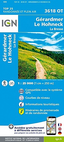
1 / Départ : Parking Lac Blanc (1063 m)
Lat/Lon : 48.12543/7.09597
 Actions
12 km

+509 m/-511 m

04:15

Cliquez pour activer


Cliquez et déplacez la souris sur le profil pour analyser un tronçon (2 doigts sur mobile)
Détails
2/ Prendre le sentier Lac Noir par Rocher Hans Observa Belmont suivre le balisage cercle rouge (1070 m)
Lat/Lon : 48.12478/7.09628
3/ Rocher Hans (1147 m)
Lat/Lon : 48.1229/7.09326
4/ Prendre a gauche direction Lac Noir Paris Orbey balisage croix jaune (1230 m)
Lat/Lon : 48.12003/7.09496
5/ Observatoire belmont (1212 m)
Lat/Lon : 48.12002/7.09535
6/ Prendre a gauche (1224 m)
Lat/Lon : 48.11969/7.09496
7/ Prendre a gauche suivre balisage cercle bleu lac noir (1207 m)
Lat/Lon : 48.11915/7.0943
8/ Allez en face suivre balisage cercle bleu (1067 m)
Lat/Lon : 48.11672/7.09931
9/ Prendre a droite suivre balisage rond bleu (1038 m)
Lat/Lon : 48.11545/7.09932
10/ Lac noir bifurquez vers la droite vers le sentier qui longe le Lac Noir et passez le petit pont suivre le balisage rond bleu grand tour du lac noir (958 m)
Lat/Lon : 48.1128/7.09983
11/ Bifurquez a droite suivre balisage rond bleu (1030 m)
Lat/Lon : 48.10972/7.09631
12/ Prendre a gauche sur la route forestière (1064 m)
Lat/Lon : 48.10967/7.09427
13/ Prendre a droite suivre balisage triangle jaune direction altenraechkop (1124 m)
Lat/Lon : 48.10364/7.09377
14/ Altenkopf (1258 m)
Lat/Lon : 48.10656/7.08294
15/ Tournez a droite et suivre la balisage rectangle rouge (1295 m)
Lat/Lon : 48.10867/7.0767
16/ Prendre a droite pour rejoindre la source du Lac Blanc (1293 m)
Lat/Lon : 48.12078/7.08304
17/ Prendre a gauche direction calvaire ti froncé par bord de crête balisage cercle rouge (1281 m)
Lat/Lon : 48.1204/7.08568
18/ Banc (1226 m)
Type : possibilité de se reposer
Lat/Lon : 48.12773/7.08477
Arrivée Parking Lac Blanc (1063 m)
Lat/Lon : 48.12543/7.09597
Commentaires
Pas encore de commentaire, connectez-vous pour en ajouter un.
Connectez-vous pour ajouter un commentaire
Longueur et nombre de points

11.97 km

2286 pts

19 marqueurs
Denivelé et altitude
Calculés avec un seuil de 30 mètres et un lissage sur 13 points (corrigé car densité de points faible)

508 m

511 m

1351 m

1006 m

1209 m
Date et durée

04 juillet 2020
09:56

04 juillet 2020
15:45

05:48:27

04:11:05

01:37:22
Vitesses et denivelés horaires

2.9 km/h
Détail »

17.1 km/h
au km 4.3

244 m/h
2h02m58s

-326 m/h
1h29m53s
| km | Temps | Vitesse | Pause |
|---|
| 1 | 50'06" | 1.2 km/h | 17'54" |
| 2 | 17'56" | 3.3 km/h | 08'41" |
| 3 | 16'51" | 3.6 km/h | |
| 4 | 20'54" | 2.9 km/h | 07'32" |
| 5 | 14'20" | 4.2 km/h | 05'08" |
| 6 | 18'59" | 3.2 km/h | 01'51" |
| 7 | 17'49" | 3.4 km/h | 40'44" |
| 8 | 13'25" | 4.5 km/h | |
| 9 | 24'54" | 2.4 km/h | 02'18" |
| 10 | 15'42" | 3.8 km/h | 01'51" |
| 11 | 20'20" | 3 km/h | |
Dépense calorique (estimation)

454 Cal
108 Cal/h
Plus

Affichée 11591 fois et téléchargée 723 fois depuis le 07.07.20 07:17
Carte + Profil [Afficher un aperçu]
<iframe src="https://www.visugpx.com/82hdNNqYMQ?iframe" allowfullscreen style="border: 0;width: 100%; height: 540px;" scrolling="no"></iframe>
Carte uniquement [Afficher un aperçu]
<iframe src="https://www.visugpx.com/82hdNNqYMQ?iframe&maponly" allowfullscreen style="border: 0;width: 100%; height: 540px;" scrolling="no"></iframe>


Nous avons pris en compte votre choix.
Vous souhaitez maîtriser les informations qui peuvent être recueillies lors de votre navigation et avez refusé les cookies de personnalisation des annonces, c'est légitime.
Parce que le service fourni par VisuGPX a un coût, accepteriez-vous quand même que nous utilisions des cookies pour vous présenter des annonces non personnalisées ? Ces cookies ne sont pas des cookies de tracking mais de simples des cookies techniques de diffusion qui garantissent le respect votre vie privée.


 Actions
  12 km
12 km +509 m/-511 m
 04:15
04:15

 Cliquez et déplacez la souris sur le profil pour analyser un tronçon (2 doigts sur mobile)
 62
62 125
125 68 [Légende]


 Pour soutenir VisuGPX, faites le bon choix