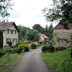
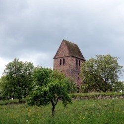
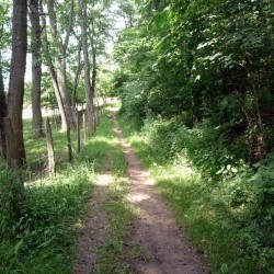
Ce circuit fait le tour de la forêt du Tannenwald. Il relie Marmoutier, la chapelle du Sindelsberg, Air et Vie, l'aire de piquenique de la Förstermatt, le Moulin de Champagne, le hameau du Buchberg, Dimbsthal, la Croix du Rasten et le sommet du Heckberg.
Il est balisé avec un anneau bleu.
Départs possibles à Marmoutier, Air et Vie, Moulin de Champagne, Buchberg et Dimbsthal
 Actions
12 km

+240 m/-239 m

±03:45

Cliquez pour activer

Cliquez et déplacez la souris sur le profil pour analyser un tronçon (2 doigts sur mobile)
Détails
www.club-vosgien-marmoutier.org 
 Photos
Commentaires
Pas encore de commentaire, connectez-vous pour en ajouter un.
Connectez-vous pour ajouter un commentaire
Longueur et nombre de points

12.31 km

286 pts

21 marqueurs
Denivelé et altitude
Calculés avec un seuil de 5 mètres et un lissage sur 3 points

240 m

240 m

353 m

222 m

284 m
Plus

Affichée 7147 fois et téléchargée 497 fois depuis le 05.01.17 06:08
Carte + Profil [Afficher un aperçu]
<iframe src="https://www.visugpx.com/7Ipd3JtXrt?iframe" allowfullscreen style="border: 0;width: 100%; height: 540px;" scrolling="no"></iframe>
Carte uniquement [Afficher un aperçu]
<iframe src="https://www.visugpx.com/7Ipd3JtXrt?iframe&maponly" allowfullscreen style="border: 0;width: 100%; height: 540px;" scrolling="no"></iframe>
Nous avons pris en compte votre choix.
Vous souhaitez maîtriser les informations qui peuvent être recueillies lors de votre navigation et avez refusé les cookies de personnalisation des annonces, c'est légitime.
Parce que le service fourni par VisuGPX a un coût, accepteriez-vous quand même que nous utilisions des cookies pour vous présenter des annonces non personnalisées ? Ces cookies ne sont pas des cookies de tracking mais de simples des cookies techniques de diffusion qui garantissent le respect votre vie privée.


 Actions
  12 km
12 km +240 m/-239 m
 ±03:45
 Cliquez et déplacez la souris sur le profil pour analyser un tronçon (2 doigts sur mobile)


 43
43 71
71 23 [Légende]
 Pour soutenir VisuGPX, faites le bon choix