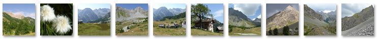
2015-07 - Ponte Maira - Colle Ciarbonet - Viviere - Vallonetto - Colletto II - Viviere
 Actions
17.7 km

+1678 m
/-1266 m
06:13

Cliquez pour activer


Cliquez et déplacez la souris sur le profil pour analyser un tronçon (2 doigts sur mobile)
Détails
album :
goo.gl/photos/ZLv19qGjdWvp5Gfv7

 Idées de randonnées dans la même région
Parcours :
www.visugpx.com/membres/24856/montagne/alpes/
Photos :
jcvertygo.blogspot.com/p/les-alpes.htmlCommentaires
Pas encore de commentaire, connectez-vous pour en ajouter un.
Connectez-vous pour ajouter un commentaire
Longueur et nombre de points

17.69 km

1831 pts
Denivelé et altitude
Calculés avec un seuil de 10 mètres et un lissage sur 5 points

1678 m

1267 m

2640 m

1407 m

2043 m
Date et durée

18 juillet 2015
10:54

18 juillet 2015
18:13

07:19:06

06:13:24

01:05:42
Vitesses et denivelés horaires

2.8 km/h
Détail »

6.1 km/h
au km 6.9

452 m/h
3h37m24s

-547 m/h
2h14m17s
| km | Temps | Vitesse | Pause |
|---|
| 1 | 29'40" | 2 km/h | |
| 2 | 20'58" | 2.9 km/h | |
| 3 | 27'09" | 2.2 km/h | 02'05" |
| 4 | 26'22" | 2.3 km/h | |
| 5 | 21'09" | 2.8 km/h | |
| 6 | 14'42" | 4.1 km/h | |
| 7 | 13'30" | 4.4 km/h | |
| 8 | 14'28" | 4.1 km/h | |
| 9 | 23'28" | 2.6 km/h | 35'15" |
| 10 | 20'38" | 2.9 km/h | |
| 11 | 22'35" | 2.7 km/h | |
| 12 | 19'57" | 3 km/h | |
| 13 | 27'30" | 2.2 km/h | |
| 14 | 33'25" | 1.8 km/h | 22'57" |
| 15 | 17'24" | 3.4 km/h | |
| 16 | 14'52" | 4 km/h | |
| 17 | 12'19" | 4.9 km/h | 05'25" |
Dépense calorique (estimation)

1339 Cal
215 Cal/h
Plus

Affichée 856 fois et téléchargée 37 fois depuis le 07.04.20 15:25
KME
38.7 kilomètres effort
Carte + Profil [Afficher un aperçu]
<iframe src="https://www.visugpx.com/3R8HCHyrbo?iframe" allowfullscreen style="border: 0;width: 100%; height: 540px;" loading="lazy" scrolling="no"></iframe>
Carte uniquement [Afficher un aperçu]
<iframe src="https://www.visugpx.com/3R8HCHyrbo?iframe&maponly" allowfullscreen style="border: 0;width: 100%; height: 540px;" loading="lazy" scrolling="no"></iframe>

 ForumsToposLes plus belles randosSegments
 Offre Premium
 Connexion


 161
161 376
376 195 [Légende]


