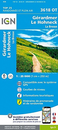
Faite le 14/02/2021
2h45 - toujours au soleil
Possibilité de réduire (un peu) - retour prendre directement boule rouge après le Raindé)
Pas mal de possibilités pour allonger à partir du Haut du Raindé, (après le musée de la bataille des Hautes Vosges, poursuivre en montant).
En chemin :
- auberge du Couchetat (la Basse des Feignes)
- Ferme des lamas (peu après la Basse des Feignes)
 Actions
7 km

+336 m/-337 m

02:15

Cliquez pour activer


Cliquez et déplacez la souris sur le profil pour analyser un tronçon (2 doigts sur mobile)
Commentaires
Pas encore de commentaire, connectez-vous pour en ajouter un.
Connectez-vous pour ajouter un commentaire
Longueur et nombre de points

7.02 km

854 pts
Denivelé et altitude
Calculés avec un seuil de 10 mètres et un lissage sur 5 points

336 m

337 m

907 m

609 m

768 m
Date et durée

14 février 2021
12:13

14 février 2021
14:53

02:40:19

02:14:21

00:25:58
Vitesses et denivelés horaires

3.1 km/h
Détail »

5 km/h
au km 6.9

342 m/h
0h54m03s

-317 m/h
0h59m14s
| km | Temps | Vitesse | Pause |
|---|
| 1 | 22'58" | 2.6 km/h | 02'04" |
| 2 | 19'35" | 3.1 km/h | 02'41" |
| 3 | 18'05" | 3.3 km/h | 06'28" |
| 4 | 20'15" | 3 km/h | 12'48" |
| 5 | 17'52" | 3.4 km/h | 01'57" |
| 6 | 19'20" | 3.1 km/h | |
| 7 | 15'34" | 3.9 km/h | |
Dépense calorique (estimation)

301 Cal
135 Cal/h
Plus

Affichée 492 fois et téléchargée 42 fois depuis le 14.02.21 17:16
Carte + Profil [Afficher un aperçu]
<iframe src="https://www.visugpx.com/2c4m3qGtf4?iframe" allowfullscreen style="border: 0;width: 100%; height: 540px;" scrolling="no"></iframe>
Carte uniquement [Afficher un aperçu]
<iframe src="https://www.visugpx.com/2c4m3qGtf4?iframe&maponly" allowfullscreen style="border: 0;width: 100%; height: 540px;" scrolling="no"></iframe>


Nous avons pris en compte votre choix.
Vous souhaitez maîtriser les informations qui peuvent être recueillies lors de votre navigation et avez refusé les cookies de personnalisation des annonces, c'est légitime.
Parce que le service fourni par VisuGPX a un coût, accepteriez-vous quand même que nous utilisions des cookies pour vous présenter des annonces non personnalisées ? Ces cookies ne sont pas des cookies de tracking mais de simples des cookies techniques de diffusion qui garantissent le respect votre vie privée.


 Actions
  7 km
7 km +336 m/-337 m
 02:15
02:15

 Cliquez et déplacez la souris sur le profil pour analyser un tronçon (2 doigts sur mobile)
 40
40 79
79 37 [Légende]

 Pour soutenir VisuGPX, faites le bon choix