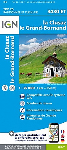
Au départ de Romme, on prend le chemin carrossable montant au chalets de Vormy. Avant ce village, on quitte ce chemin pour prendre un sentier jusqu à la tête du château. Puis, on suit la combe pour atteindre la crête à 2478m. On s arrêtera au premier sommet. La suite demande un pied aguerri et une corde.
 Actions
11 km

+1255 m/-83 m

03:30

Cliquez pour activer


Cliquez et déplacez la souris sur le profil pour analyser un tronçon (2 doigts sur mobile)
Commentaires
Pas encore de commentaire, connectez-vous pour en ajouter un.
Connectez-vous pour ajouter un commentaire
Longueur et nombre de points

11.06 km

1277 pts
Denivelé et altitude
Calculés avec un seuil de 10 mètres et un lissage sur 5 points

1255 m

84 m

2466 m

1263 m

1816 m
Date et durée

14 août 2014
09:50

14 août 2014
14:48

04:58:24

03:27:12

01:31:12
Vitesses et denivelés horaires

3.2 km/h
Détail »

4.7 km/h
au km 1.1

396 m/h
3h04m19s

-237 m/h
0h06m38s
| km | Temps | Vitesse | Pause |
|---|
| 1 | 18'12" | 3.3 km/h | |
| 2 | 16'54" | 3.6 km/h | |
| 3 | 18'31" | 3.2 km/h | |
| 4 | 15'18" | 3.9 km/h | 05'24" |
| 5 | 18'52" | 3.2 km/h | |
| 6 | 19'07" | 3.1 km/h | |
| 7 | 17'55" | 3.3 km/h | |
| 8 | 18'02" | 3.3 km/h | 13'45" |
| 9 | 15'30" | 3.9 km/h | |
| 10 | 22'43" | 2.6 km/h | 17'07" |
| 11 | 24'35" | 2.4 km/h | 54'56" |
Dépense calorique (estimation)

953 Cal
276 Cal/h
Plus

Affichée 876 fois et téléchargée 20 fois depuis le 07.04.20 15:25
Carte + Profil [Afficher un aperçu]
<iframe src="https://www.visugpx.com/1408139219?iframe" allowfullscreen style="border: 0;width: 100%; height: 540px;" scrolling="no"></iframe>
Carte uniquement [Afficher un aperçu]
<iframe src="https://www.visugpx.com/1408139219?iframe&maponly" allowfullscreen style="border: 0;width: 100%; height: 540px;" scrolling="no"></iframe>

Nous avons pris en compte votre choix.
Vous souhaitez maîtriser les informations qui peuvent être recueillies lors de votre navigation et avez refusé les cookies de personnalisation des annonces, c'est légitime.
Parce que le service fourni par VisuGPX a un coût, accepteriez-vous quand même que nous utilisions des cookies pour vous présenter des annonces non personnalisées ? Ces cookies ne sont pas des cookies de tracking mais de simples des cookies techniques de diffusion qui garantissent le respect votre vie privée.


 Actions
  11 km
11 km +1255 m/-83 m
 03:30
03:30

 Cliquez et déplacez la souris sur le profil pour analyser un tronçon (2 doigts sur mobile)
 93
93 191
191 132 [Légende]
 Pour soutenir VisuGPX, faites le bon choix