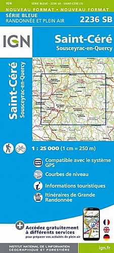
Au départ de Lamativie dans le Lot, aux confins du département, près du Cantal et de la Corrèze, Boucle de 25 km, très sportive dans la zone des gorges. Un aller et retour sportif permet d'admirer la cascade de Vieyres. Tous le chemins sont publics.
 Actions
25 km

+1696 m/-1710 m

06:15

Cliquez pour activer


Cliquez et déplacez la souris sur le profil pour analyser un tronçon (2 doigts sur mobile)
Commentaires
Pas encore de commentaire, connectez-vous pour en ajouter un.
Connectez-vous pour ajouter un commentaire
Longueur et nombre de points

24.63 km

2167 pts
Denivelé et altitude
Calculés avec un seuil de 10 mètres et un lissage sur 5 points

1696 m

1710 m

605 m

211 m

460 m
Date et durée

04 mai 2014
09:16

04 mai 2014
17:07

07:51:23

06:21:08

01:30:15
Vitesses et denivelés horaires

3.9 km/h
Détail »

8.8 km/h
au km 13.9

434 m/h
2h57m05s

-627 m/h
2h04m33s
| km | Temps | Vitesse | Pause |
|---|
| 1 | 12'14" | 4.9 km/h | |
| 2 | 15'24" | 3.9 km/h | |
| 3 | 14'27" | 4.2 km/h | |
| 4 | 13'36" | 4.4 km/h | 37'20" |
| 5 | 16'03" | 3.7 km/h | |
| 6 | 30'31" | 2 km/h | 12'00" |
| 7 | 17'41" | 3.4 km/h | 01'50" |
| 8 | 12'25" | 4.8 km/h | |
| 9 | 14'03" | 4.3 km/h | 07'22" |
| 10 | 15'40" | 3.8 km/h | 26'05" |
| 11 | 12'41" | 4.7 km/h | |
| 12 | 14'21" | 4.2 km/h | |
| 13 | 22'25" | 2.7 km/h | |
| 14 | 21'27" | 2.8 km/h | |
| 15 | 12'24" | 4.8 km/h | |
| 16 | 17'35" | 3.4 km/h | |
| 17 | 13'02" | 4.6 km/h | |
| 18 | 12'08" | 4.9 km/h | |
| 19 | 13'00" | 4.6 km/h | |
| 20 | 11'57" | 5 km/h | 05'38" |
| 21 | 13'48" | 4.3 km/h | |
| 22 | 16'19" | 3.7 km/h | |
| 23 | 12'44" | 4.7 km/h | |
| 24 | 15'03" | 4 km/h | |
Dépense calorique (estimation)

1459 Cal
230 Cal/h
Plus

Affichée 2891 fois et téléchargée 123 fois depuis le 05.05.14 07:38
Carte + Profil [Afficher un aperçu]
<iframe src="https://www.visugpx.com/1399268319?iframe" allowfullscreen style="border: 0;width: 100%; height: 540px;" scrolling="no"></iframe>
Carte uniquement [Afficher un aperçu]
<iframe src="https://www.visugpx.com/1399268319?iframe&maponly" allowfullscreen style="border: 0;width: 100%; height: 540px;" scrolling="no"></iframe>

Nous avons pris en compte votre choix.
Vous souhaitez maîtriser les informations qui peuvent être recueillies lors de votre navigation et avez refusé les cookies de personnalisation des annonces, c'est légitime.
Parce que le service fourni par VisuGPX a un coût, accepteriez-vous quand même que nous utilisions des cookies pour vous présenter des annonces non personnalisées ? Ces cookies ne sont pas des cookies de tracking mais de simples des cookies techniques de diffusion qui garantissent le respect votre vie privée.


 Actions
  25 km
25 km +1696 m/-1710 m
 06:15
06:15

 Cliquez et déplacez la souris sur le profil pour analyser un tronçon (2 doigts sur mobile)
 121
121 265
265 164 [Légende]
 Pour soutenir VisuGPX, faites le bon choix