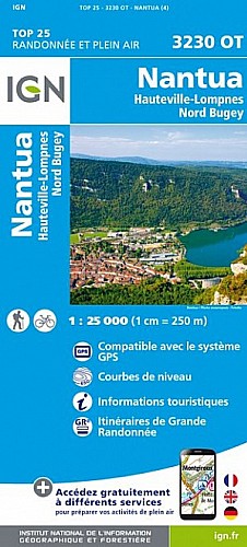
Champdor - Rougemont- Champdor
par la ferme de la Bertinière.
KMS 6à7 :Vérifier les % de pentes : : Montée assez raide du point 820 à Rougemont
KMS 11à12 :plein nord après la Bertinière jusqu'au Charmettes:il faut prendre à droite tout de suite après le G de GR, et faire le tour du prè par l'est. Le pré est fermé on ne peut plus prendre le chemin qui était balisé, et il y a des chx dans le pré. Il y a un chemin qui fait le tour et arrive au niveau de "la petite berche,grange"
 Actions
18 km

+274 m/-308 m

Cliquez pour activer

Cliquez et déplacez la souris sur le profil pour analyser un tronçon (2 doigts sur mobile)
Commentaires
Pas encore de commentaire, connectez-vous pour en ajouter un.
Connectez-vous pour ajouter un commentaire
Longueur et nombre de points

18.41 km

241 pts
Denivelé et altitude
Calculés avec un seuil de 10 mètres et un lissage sur 3 points (corrigé car densité de points faible)

274 m

308 m

954 m

811 m

865 m
Plus

Affichée 611 fois et téléchargée 23 fois depuis le 19.01.14 08:44
Carte + Profil [Afficher un aperçu]
<iframe src="https://www.visugpx.com/1390117483?iframe" allowfullscreen style="border: 0;width: 100%; height: 540px;" scrolling="no"></iframe>
Carte uniquement [Afficher un aperçu]
<iframe src="https://www.visugpx.com/1390117483?iframe&maponly" allowfullscreen style="border: 0;width: 100%; height: 540px;" scrolling="no"></iframe>


Nous avons pris en compte votre choix.
Vous souhaitez maîtriser les informations qui peuvent être recueillies lors de votre navigation et avez refusé les cookies de personnalisation des annonces, c'est légitime.
Parce que le service fourni par VisuGPX a un coût, accepteriez-vous quand même que nous utilisions des cookies pour vous présenter des annonces non personnalisées ? Ces cookies ne sont pas des cookies de tracking mais de simples des cookies techniques de diffusion qui garantissent le respect votre vie privée.


 Actions
  18 km
18 km +274 m/-308 m
 Cliquez et déplacez la souris sur le profil pour analyser un tronçon (2 doigts sur mobile)
 55
55 92
92 24 [Légende]

 Pour soutenir VisuGPX, faites le bon choix