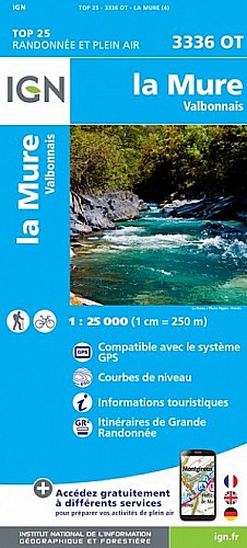
De Moulin Vieux gagner la cabane de Combe Oursière(1720) puis monter dans les rhodo en suivant une vague sente qui se rapproche de la falaise pour déboucher au col 2062m
Suivre l'arête jusqu'à Roche Frette puis la tête de Barbalon.
descente sur la cabane du Rocher Roux par un chemin de crête
par des pistes forestières regagner le parking
 Actions
12 km

+1330 m/-1374 m

05:15

Cliquez pour activer


Cliquez et déplacez la souris sur le profil pour analyser un tronçon (2 doigts sur mobile)
Commentaires
Pas encore de commentaire, connectez-vous pour en ajouter un.
Connectez-vous pour ajouter un commentaire
Longueur et nombre de points

12.26 km

1266 pts
Denivelé et altitude
Calculés avec un seuil de 10 mètres et un lissage sur 5 points

1329 m

1374 m

2374 m

1129 m

1583 m
Date et durée

29 novembre 2011
09:02

29 novembre 2011
17:23

08:21:36

05:10:59

03:10:37
Vitesses et denivelés horaires

2.4 km/h
Détail »

15.7 km/h
au km 1.7

445 m/h
2h48m38s

-636 m/h
2h05m19s
| km | Temps | Vitesse | Pause |
|---|
| 1 | 22'11" | 2.7 km/h | 02'22" |
| 2 | 23'15" | 2.6 km/h | 12'22" |
| 3 | 31'52" | 1.9 km/h | 08'45" |
| 4 | 38'53" | 1.5 km/h | 13'38" |
| 5 | 42'14" | 1.4 km/h | 100'33" |
| 6 | 29'57" | 2 km/h | 11'51" |
| 7 | 33'16" | 1.8 km/h | 35'10" |
| 8 | 18'58" | 3.2 km/h | 02'51" |
| 9 | 19'41" | 3 km/h | |
| 10 | 18'10" | 3.3 km/h | 03'05" |
| 11 | 14'24" | 4.2 km/h | |
| 12 | 14'30" | 4.1 km/h | |
Dépense calorique (estimation)

1037 Cal
200 Cal/h
Plus

Affichée 705 fois et téléchargée 30 fois depuis le 07.04.20 15:25
Carte + Profil [Afficher un aperçu]
<iframe src="https://www.visugpx.com/1322662499?iframe" allowfullscreen style="border: 0;width: 100%; height: 540px;" scrolling="no"></iframe>
Carte uniquement [Afficher un aperçu]
<iframe src="https://www.visugpx.com/1322662499?iframe&maponly" allowfullscreen style="border: 0;width: 100%; height: 540px;" scrolling="no"></iframe>

Nous avons pris en compte votre choix.
Vous souhaitez maîtriser les informations qui peuvent être recueillies lors de votre navigation et avez refusé les cookies de personnalisation des annonces, c'est légitime.
Parce que le service fourni par VisuGPX a un coût, accepteriez-vous quand même que nous utilisions des cookies pour vous présenter des annonces non personnalisées ? Ces cookies ne sont pas des cookies de tracking mais de simples des cookies techniques de diffusion qui garantissent le respect votre vie privée.


 Actions
  12 km
12 km +1330 m/-1374 m
 05:15
05:15

 Cliquez et déplacez la souris sur le profil pour analyser un tronçon (2 doigts sur mobile)
 142
142 370
370 124 [Légende]
 Pour soutenir VisuGPX, faites le bon choix