
Cliquez pour activer

Cliquez et déplacez la souris sur le profil pour analyser un tronçon (2 doigts sur mobile)
Détails
 Rando Club Yerrois
Date
Rando Club Yerrois
Date : Mercredi 5 Aout 2020
Animateurs :Christine M sous tutorat Brigitte
Groupe : 12-15 km
Effectif : np
Remarque particulière : Ce fichier est une trace mais la randonnée a été effectuée sans aucun changement par rapport à celle ci ( enregistrement incomplet).
Aucune difficulté sur cette sortie qui permet de bénéficier de la fraicheur des bois en après midi à cette période
Avertissement Toutes les randonnées répertoriées dans la randothèque du
Rando
Club
Yerrois ont été tracées par l'un de nos animateurs, puis reconnues et enfin effectuées avec un groupe. Pour votre sécurité, regardez toujours la date à laquelle la sortie a été effectuée - Nous tachons de mentionner des conditions météos particulières ou les difficultés éventuelles. N'oubliez jamais les consignes supplémentaires de sécurité.
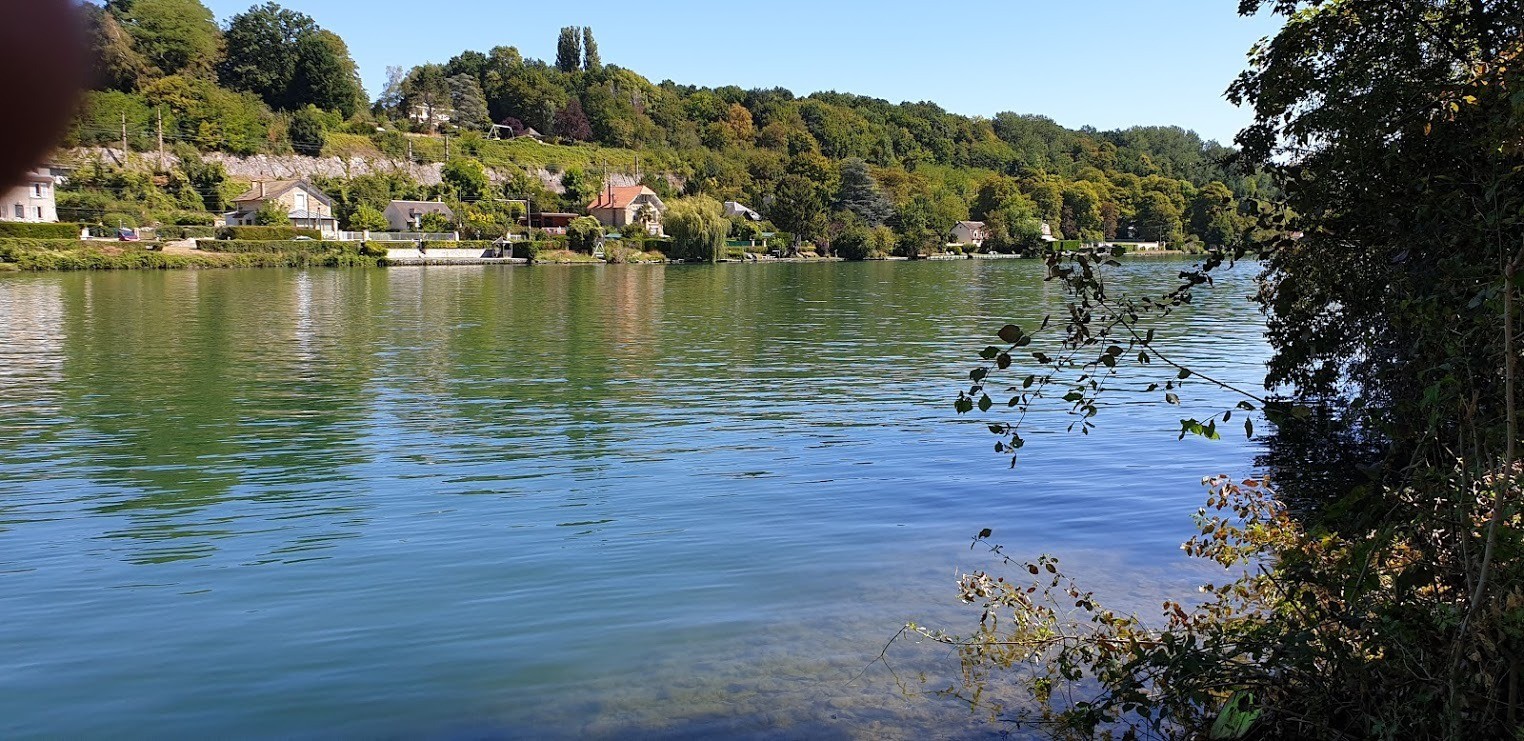
 Photos
Commentaires
Pas encore de commentaire, connectez-vous pour en ajouter un.
Connectez-vous pour ajouter un commentaire
Longueur et nombre de points

13.49 km

518 pts
Denivelé et altitude
Calculés avec un seuil de 10 mètres et un lissage sur 5 points

61 m

65 m

86 m

42 m

57 m
Plus

Affichée 690 fois et téléchargée 34 fois depuis le 24.08.20 20:20
KME
14.3 kilomètres effort
Carte + Profil [Afficher un aperçu]
<iframe src="https://www.visugpx.com/0kS9OjmGbC?iframe" allowfullscreen style="border: 0;width: 100%; height: 540px;" loading="lazy" scrolling="no"></iframe>
Carte uniquement [Afficher un aperçu]
<iframe src="https://www.visugpx.com/0kS9OjmGbC?iframe&maponly" allowfullscreen style="border: 0;width: 100%; height: 540px;" loading="lazy" scrolling="no"></iframe>


 ForumsToposLes plus belles randosSegments
 Offre Premium
 Connexion


 36
36 49
49 3 [Légende]


 13.5 km
 +61 m
+61 m ±03:30